Area Overview for ME9 8SS
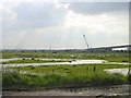
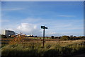
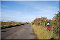
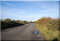
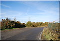
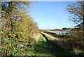
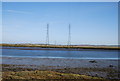
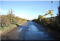
Photos of ME9 8SS

Area Information
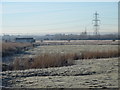
ME9 8SS is a small, residential postcode area in England, covering 35.5 hectares and home to 1,937 residents. With a population density of 196 people per square kilometre, it is a compact community where daily life is shaped by its modest size and proximity to key amenities. The area is characterised by a predominance of houses, reflecting a settled, long-term population. Most residents are adults aged 30–64, contributing to a mature, stable neighbourhood. Living in ME9 8SS means navigating a mix of practical needs and environmental considerations. While the area lacks major urban infrastructure, its proximity to rail stations and retail outlets offers convenience. However, the high flood risk score of 99.92 underscores the need for caution, particularly for those considering property in this part of the country. Despite this, the area’s low crime risk—scored 79 out of 100—suggests a generally safe environment. For those prioritising a quiet, residential setting with access to local services, ME9 8SS presents a specific set of trade-offs.
- Area Type
- Postcode
- Area Size
- 35.5 hectares
- Population
- 1937
- Population Density
- 196 people/km²
The property market in ME9 8SS is dominated by owner-occupied homes, with 82% of residents living in properties they own. This suggests a stable market with limited rental activity, which may appeal to buyers seeking long-term investment or a place to settle. The accommodation type is primarily houses, indicating a low-rise, residential character rather than apartments or terraced housing. Given the area’s small size—35.5 hectares—and modest population, the housing stock is likely limited in scale. Buyers should consider the area’s constraints, such as the high flood risk, which could impact property values or insurance costs. For those prioritising a quiet, suburban environment with a focus on homeownership, ME9 8SS offers a specific niche, though its small size means the immediate surroundings are critical for assessing broader housing options.
House Prices in ME9 8SS
Showing 1 properties
| Address | Type | Beds | Baths | Last Sale Price | Last Sale Date | |
|---|---|---|---|---|---|---|
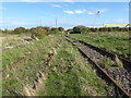
| Southeastern, Swale Railway Station, Sheppey Way, Kingsferry Rbt To Kingsferry Bridge, Iwade, ME9 8SS | commercial | - | - | - | - |
Energy Efficiency in ME9 8SS
Residents of ME9 8SS have access to a range of amenities within practical reach, including five retail outlets such as Morrisons Rushenden, Aldi Neats, and Iceland Queenborough. These stores provide essential shopping options, from groceries to household goods. The area’s rail network, with five stations including Swale and Queenborough, offers connectivity to nearby towns and services. While the data does not list parks or leisure facilities, the presence of retail and transport hubs suggests a functional lifestyle. The modest size of ME9 8SS means that daily life revolves around these nearby points, requiring residents to plan trips to larger centres for more specialised services. The combination of retail access and rail links supports a practical, low-maintenance lifestyle, though the area’s environmental risks may influence long-term convenience.
Amenities
Schools
Residents of ME9 8SS have access to two nearby schools: Iwade Community Primary School, a primary school, and Iwade School, an academy. These institutions cater to different educational stages, providing a range of options for families. The presence of both a primary school and an academy suggests a mix of traditional and possibly specialist educational approaches. However, the data does not include Ofsted ratings for these schools, so prospective families should conduct further research to evaluate academic performance and facilities. The proximity of these schools within practical reach of the area makes ME9 8SS a viable option for those prioritising access to local education. The absence of additional schools in the data means the current selection is limited, which could be a consideration for households with multiple children or specific educational needs.
| Rank | School | Type | Entry gender | Ages |
|---|
Explore more schools in this area
Go to Schools tabDemographics
The community in ME9 8SS is predominantly composed of adults aged 30–64, making up the most common age range. The median age of 47 indicates a mature population, with 82% of residents owning their homes. This high homeownership rate suggests a stable, long-term demographic profile. The accommodation type is primarily houses, reflecting a residential area with limited high-density housing. The predominant ethnic group is White, aligning with broader regional trends. With a population of 1,937 spread across 35.5 hectares, the area maintains a low population density of 196 people per square kilometre. This density supports a quiet, suburban lifestyle but may limit access to larger urban amenities. The absence of significant deprivation data means the quality of life here is likely shaped by the balance between local services and environmental constraints.
Household Size
Accommodation Type
Tenure
Ethnic Group
Religion
Household Composition
Age
Household Deprivation
NS-SEC
Explore more demographic insights in this area
Go to Demographics tabPlanning
Planning Constraints
- Flood RiskPremium
- Ramsar Wetland SitesPremium
- Area of Outstanding Natural BeautyPremium
- Protected Nature ReservePremium
- Protected WoodlandPremium