Area Overview for ME9 8JS
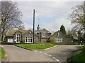
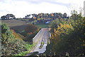
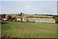
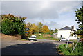
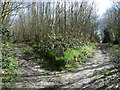
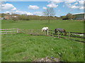
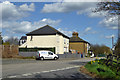
Photos of ME9 8JS


Area Information
ME9 8JS is a small, tightly knit residential area in England, spanning 47.7 hectares and home to 2,599 residents. Its compact size fosters a close-knit community, with a population density of 362 people per square kilometre. The area is characterised by a mature demographic, with a median age of 47 and the majority of residents falling within the 30–64 age range. This suggests a stable, established population, often families or long-term residents. The area’s housing stock is predominantly owner-occupied, with 80% of homes owned by their occupants, and most properties are houses rather than flats. Living here offers a balance of privacy and proximity to essential services, with nearby schools, retail, and rail links. The low population density and limited housing stock mean the area is not sprawling, creating a sense of intimacy. For those seeking a quiet, family-friendly environment with practical amenities, ME9 8JS provides a straightforward, no-frills lifestyle. Its small footprint ensures that daily needs are within easy reach, though it lacks the sprawling infrastructure of larger towns.
- Area Type
- Postcode
- Area Size
- 47.7 hectares
- Population
- 2599
- Population Density
- 362 people/km²
The property market in ME9 8JS is dominated by owner-occupied homes, with 80% of properties owned by their residents. This high rate of home ownership suggests a stable, long-term population with a strong sense of community. The area’s housing stock is primarily composed of houses, rather than flats or apartments, which is typical of smaller, rural or semi-rural postcode areas. Given the small size of the area—just 47.7 hectares—the housing stock is limited, meaning the market is likely to be tight for buyers. This scarcity of properties may drive up prices or reduce availability for those seeking to move into the area. The focus on single-family homes indicates that ME9 8JS is not a rental hotspot but rather a place where residents are likely to stay for extended periods. For buyers, this means a market that is more about long-term investment than short-term turnover, with properties potentially holding value due to their scarcity.
House Prices in ME9 8JS
Showing 13 properties
| Address | Type | Beds | Baths | Last Sale Price | Last Sale Date | |
|---|---|---|---|---|---|---|
| 1, Borden Hall Cottages, School Lane, Borden, ME9 8JS | Semi-detached | 3 | 1 | £485,000 | Jun 2021 | |
| Sorrento, School Lane, Borden, ME9 8JS | Bungalow | - | - | £300,000 | Apr 2021 | |
| Fifield Lodge, School Lane, Borden, ME9 8JS | Detached | 5 | 3 | £1,100,000 | Aug 2018 | |
| Church Hill House, School Lane, Borden, ME9 8JS | Detached | - | - | £190,000 | Jun 1998 | |
| Burstall House, School Lane, Borden, ME9 8JS | Retail | 6 | 2 | - | - | |
| Northfield Farm, School Lane, Borden, ME9 8JS | Farm | - | - | - | - | |
| 2, Borden Hall Cottages, School Lane, Borden, ME9 8JS | Semi-detached | - | - | - | - | |
| Lyndum, School Lane, Borden, ME9 8JS | Detached | 2 | 1 | - | - | |
| Tandlehills, School Lane, Borden, ME9 8JS | Detached | - | - | - | - | |
| Northfield, School Lane, Borden, ME9 8JS | house | - | - | - | - |
Energy Efficiency in ME9 8JS
The lifestyle in ME9 8JS is shaped by its proximity to essential amenities. Within practical reach are five retail outlets, including Co-op Grove, Budgens MRH, and Asda Sittingbourne, providing access to groceries, household goods, and daily necessities. These shops cater to the needs of a small community, reducing the need for long trips to larger towns. The area’s rail stations, such as Newington and Sittingbourne, offer connections to broader networks, enabling travel for work, leisure, or socialising. While there is no mention of parks or leisure facilities in the data, the presence of retail and transport options suggests a practical, functional lifestyle. Residents can enjoy a balance of convenience and quiet living, with services close enough to avoid the hassle of long commutes. The area’s character is defined by its simplicity, where daily life revolves around local shops, community ties, and accessible transport.
Amenities
Schools
The nearest school to ME9 8JS is Borden Church of England Primary School, which serves the local community with an outstanding Ofsted rating. This school is listed twice in the data, likely due to duplication, but it confirms that primary education is readily available within the area. The presence of a primary school with an outstanding rating is a significant advantage for families, as it ensures high-quality early education. The absence of secondary schools in the immediate vicinity means that students may need to travel to nearby towns for secondary education, but the primary school’s proximity reduces the burden on younger families. The school’s rating suggests a focus on academic excellence and pastoral care, which can be a deciding factor for parents considering the area. For those prioritising strong local schools, ME9 8JS offers a solid foundation for early education.
| Rank | School | Type | Entry gender | Ages |
|---|
Explore more schools in this area
Go to Schools tabDemographics
The community in ME9 8JS is predominantly composed of adults aged 30–64, with a median age of 47, indicating a mature, settled population. Over 80% of residents own their homes, a figure that suggests long-term residency and financial stability. The area is largely composed of houses, reflecting a preference for single-family living rather than apartments or shared housing. The predominant ethnic group is White, though specific data on diversity is not provided. The population density of 362 people per square kilometre is moderate, balancing residential space with community interaction. With no data on deprivation levels, it is reasonable to infer that the area’s higher home ownership rates and stable age profile contribute to a quality of life that prioritises security and continuity. This demographic profile aligns with a community that values stability, with residents likely to be employed in local or regional industries, given the absence of large-scale employment hubs nearby.
Household Size
Accommodation Type
Tenure
Ethnic Group
Religion
Household Composition
Age
Household Deprivation
NS-SEC
Explore more demographic insights in this area
Go to Demographics tabPlanning
Planning Constraints
- Flood RiskPremium
- Ramsar Wetland SitesPremium
- Area of Outstanding Natural BeautyPremium
- Protected Nature ReservePremium
- Protected WoodlandPremium