Area Overview for ME9 8FN
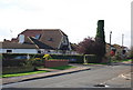
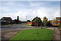
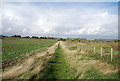
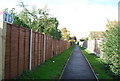
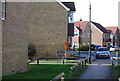
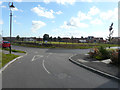
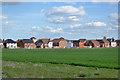
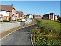
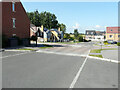
Photos of ME9 8FN


Area Information
ME9 8FN is a small, densely populated residential postcode in England, covering 2,677 square metres and home to 2,594 residents. With a population density of 835 people per square kilometre, this area is compact yet well-defined, offering a mix of housing and community life. The median age of 47 suggests a mature demographic, with most residents falling between 30 and 64 years old. This cluster of homes is predominantly owner-occupied, with 81% of properties in private hands, and the majority are houses rather than flats. Daily life here is shaped by proximity to local amenities, including five rail stations and key retail outlets. While the area lacks large-scale infrastructure, its size ensures that essential services are within walking or short driving distance. The presence of special schools and a focus on residential living makes ME9 8FN a quiet, family-oriented spot, though its small footprint means it’s best suited for those prioritising convenience over expansive space.
- Area Type
- Postcode
- Area Size
- 2677 m²
- Population
- 2594
- Population Density
- 835 people/km²
ME9 8FN is a largely owner-occupied area, with 81% of properties in private hands. The housing stock is almost exclusively houses, reflecting a residential focus rather than a mix of flats or apartments. This makes the area more suited to families or individuals seeking single-family homes rather than rental properties. The small size of the postcode means the housing market is limited in scope, with few properties available for purchase or rent. Buyers should consider the area’s proximity to rail stations and retail amenities, which may enhance its appeal. However, the lack of larger developments or a variety of housing types could restrict options for those seeking specific property features. The high home ownership rate also suggests a stable market, though the small footprint means competition for available properties may be keen.
House Prices in ME9 8FN
Showing 7 properties
| Address | Type | Beds | Baths | Last Sale Price | Last Sale Date | |
|---|---|---|---|---|---|---|
| 7 The Waterway, Iwade, ME9 8FN | house | - | - | £126,000 | Jun 2024 | |
| 3 The Waterway, Iwade, ME9 8FN | house | - | - | £56,125 | Feb 2019 | |
| 2 The Waterway, Iwade, ME9 8FN | house | - | - | - | - | |
| 5 The Waterway, Iwade, ME9 8FN | house | - | - | - | - | |
| 1 The Waterway, Iwade, ME9 8FN | house | - | - | - | - | |
| 6 The Waterway, Iwade, ME9 8FN | house | - | - | - | - | |
| 4 The Waterway, Iwade, ME9 8FN | house | - | - | - | - |
Energy Efficiency in ME9 8FN
The lifestyle in ME9 8FN is shaped by its proximity to practical amenities. Retail options include major supermarkets like Asda, Morrisons, and Tesco, ensuring residents can access groceries, household goods, and other essentials without long journeys. The area’s small size means these services are within walking or short driving distance, enhancing convenience. While no parks or leisure facilities are listed in the data, the presence of rail stations and retail hubs suggests a focus on functional living rather than expansive recreational spaces. The character of the area is defined by its compactness and accessibility, making it ideal for those prioritising ease of access to services over large-scale amenities.
Amenities
Schools
The schools nearest to ME9 8FN include Brogdale Community Interest Company and Brogdale CIC, both of which are special schools. These institutions cater to students with specific educational needs, offering tailored support and resources. The presence of two special schools in the area indicates a focus on inclusive education, though no mainstream schools are listed in the data. Families requiring special educational provisions may find this a significant advantage, but those seeking traditional primary or secondary schools will need to look beyond the immediate vicinity. The absence of other school types means parents should investigate further to ensure their child’s needs are fully met.
| Rank | School | Type | Entry gender | Ages |
|---|
Explore more schools in this area
Go to Schools tabDemographics
The community in ME9 8FN is characterised by a median age of 47, with the largest age group being adults aged 30–64. This suggests a population skewed towards middle-aged individuals, possibly reflecting a mix of long-term residents and families. Home ownership is high, with 81% of properties owned by their occupants, indicating a stable, settled community. The accommodation type is predominantly houses, which aligns with the area’s residential focus. The predominant ethnic group is White, though no specific data on diversity or deprivation is provided. The high home ownership rate and mature age profile suggest a low turnover of residents, fostering a sense of continuity. However, the lack of detailed demographic breakdowns means the full picture of the area’s social composition remains partially obscured.
Household Size
Accommodation Type
Tenure
Ethnic Group
Religion
Household Composition
Age
Household Deprivation
NS-SEC
Explore more demographic insights in this area
Go to Demographics tabPlanning
Planning Constraints
- Flood RiskPremium
- Ramsar Wetland SitesPremium
- Area of Outstanding Natural BeautyPremium
- Protected Nature ReservePremium
- Protected WoodlandPremium