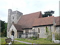
Area Overview for ME9 7TH
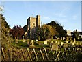
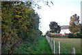
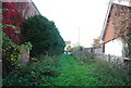
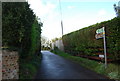
Photos of ME9 7TH
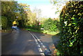

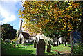


Area Information
ME9 7TH is a compact residential cluster in England, covering just 9.9 hectares and home to 1872 residents. With a population density of 191 people per square kilometre, this area is small but well-defined, offering a quiet, community-focused environment. The median age of 47 suggests a mature population, with most residents aged between 30 and 64. This demographic profile indicates a stable, established community, likely centred around family homes and local amenities. The area’s proximity to rail networks and retail hubs like M&S Medway and Asda Rainham High ensures practical access to daily essentials. While it lacks large-scale urban infrastructure, ME9 7TH’s charm lies in its simplicity—small, manageable living spaces with easy links to nearby towns. For those seeking a low-maintenance lifestyle with a strong sense of local identity, this postcode offers a blend of residential comfort and functional connectivity.
- Area Type
- Postcode
- Area Size
- 9.9 hectares
- Population
- 1872
- Population Density
- 191 people/km²
ME9 7TH is primarily an owner-occupied area, with 73% of homes owned by residents rather than rented. The accommodation type is predominantly houses, which suggests a focus on single-family homes rather than apartments or flats. This makes the area attractive to buyers seeking traditional housing stock, though the small size of the postcode—just 9.9 hectares—means the housing market is limited in scale. The high home ownership rate indicates a stable market, but buyers should consider the area’s compact nature, which may mean limited availability of new properties. For those looking to expand their search, nearby towns with rail links like Rainham and Sittingbourne offer additional options. The presence of rail stations within practical reach also supports a lifestyle where commuting to larger centres is feasible, complementing the local housing stock’s appeal.
House Prices in ME9 7TH
Showing 29 properties
| Address | Type | Beds | Baths | Last Sale Price | Last Sale Date | |
|---|---|---|---|---|---|---|
| Valley View, The Street, Hartlip, ME9 7TH | Detached | 5 | 3 | £1,150,000 | Dec 2024 | |
| Stepp House, The Street, Hartlip, ME9 7TH | Detached | - | - | £1,155,000 | Mar 2022 | |
| Sanquhar, The Street, Hartlip, ME9 7TH | Retail | 2 | 1 | £465,000 | Mar 2022 | |
| Craiglea, The Street, Hartlip, ME9 7TH | Detached | 2 | 1 | £435,000 | Sep 2020 | |
| The White House, The Street, Hartlip, ME9 7TH | Detached | 4 | 2 | £780,000 | Feb 2020 | |
| Yew Tree Cottage, The Street, Hartlip, ME9 7TH | house | - | - | £790,000 | May 2019 | |
| Tevrin, The Street, Hartlip, ME9 7TH | Bungalow | 4 | 2 | £650,000 | Jul 2016 | |
| The Maples, The Street, Hartlip, ME9 7TH | Detached | 5 | 2 | £785,000 | Jul 2015 | |
| Barrow Cottage, The Street, Hartlip, ME9 7TH | Detached | 1 | 1 | £785,000 | Jul 2014 | |
| Acorn Cottage, The Street, Hartlip, ME9 7TH | Bungalow | - | - | £499,999 | Sep 2005 |
Energy Efficiency in ME9 7TH
The lifestyle in ME9 7TH is shaped by its proximity to retail and transport hubs. Within reach are major stores like M&S Medway, Asda Rainham High, and Tesco Rainham, offering a range of shopping and dining options. The area’s rail links provide easy access to nearby towns, while Rochester Airport caters to those needing regional or international travel. Though the postcode itself is small, the surrounding area ensures residents have access to practical amenities without the need for long commutes. The presence of multiple railway stations also supports a commuter lifestyle, allowing residents to work in larger centres while enjoying the quieter, residential character of ME9 7TH. This balance of convenience and tranquillity makes daily life in the area both functional and pleasant.
Amenities
Schools
The nearest school to ME9 7TH is Hartlip Endowed Church of England Primary School, which serves the local community with a good Ofsted rating. As a primary school, it caters to children aged 4 to 11, providing a foundation for early education. The absence of secondary schools in the immediate area means families may need to consider nearby towns for secondary education, though the data does not specify alternatives. The school’s good rating reflects its quality of teaching and facilities, which is a significant advantage for parents prioritising educational standards. Given the area’s focus on homeownership and mature demographics, the school likely plays a central role in the community, supporting families with children in the early stages of their education.
| Rank | School | Type | Entry gender | Ages |
|---|
Explore more schools in this area
Go to Schools tabDemographics
The community in ME9 7TH is predominantly composed of adults aged 30 to 64, reflecting a mature, settled population. With a median age of 47, the area is less likely to have a high proportion of young families or retirees compared to other regions. Home ownership is strong, with 73% of residents owning their homes—a figure that suggests a stable housing market and long-term residency. The accommodation type is largely houses, which aligns with the area’s residential character and lower population density. The predominant ethnic group is White, though no specific data on diversity or deprivation levels is provided. The absence of detailed diversity metrics means the community’s composition remains largely unexamined in public records. For those considering ME9 7TH, the demographic profile indicates a neighbourhood where most residents are likely to be in their prime working years, with a focus on homeownership and established living patterns.
Household Size
Accommodation Type
Tenure
Ethnic Group
Religion
Household Composition
Age
Household Deprivation
NS-SEC
Explore more demographic insights in this area
Go to Demographics tabPlanning
Planning Constraints
- Flood RiskPremium
- Ramsar Wetland SitesPremium
- Area of Outstanding Natural BeautyPremium
- Protected Nature ReservePremium
- Protected WoodlandPremium