Area Overview for ME9 7SU
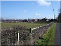
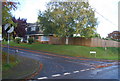
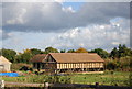
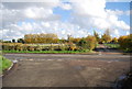
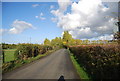
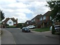
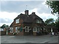
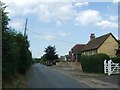
Photos of ME9 7SU


Area Information
Living in ME9 7SU means being part of a compact, residential community in England’s southeast. This postcode covers 36.4 hectares, housing 1,872 people at a density of 191 per square kilometre. The area is small but functional, with a mix of homes and accessible amenities. Daily life here is shaped by proximity to rail networks and retail hubs, offering convenience without the sprawl of larger towns. The population skews towards adults aged 30–64, suggesting a stable, established community. While the area lacks major urban features, its size ensures a quieter, more intimate living environment. Residents benefit from nearby railway stations and shopping options, making it practical for those who commute or prefer a balance between rural and urban living. ME9 7SU is not a destination for those seeking high-density living but suits those valuing simplicity, with a focus on local connectivity over sprawling developments.
- Area Type
- Postcode
- Area Size
- 36.4 hectares
- Population
- 1872
- Population Density
- 191 people/km²
The property market in ME9 7SU is characterised by a high rate of home ownership (73%) and a focus on houses rather than flats or apartments. This suggests a community of long-term residents who prioritise private, family-oriented living spaces. The small area size and limited housing stock mean the market is unlikely to be highly competitive, but buyers should consider the scarcity of new developments. With 73% of properties owner-occupied, rental options are limited, making it a less attractive area for investors seeking short-term returns. The predominance of houses also implies that properties may be larger and more suited to families than to younger buyers or those seeking smaller units. For those considering ME9 7SU, the market’s stability and low turnover could be advantageous, though the area’s size means potential buyers must look beyond immediate surroundings for more extensive choices.
House Prices in ME9 7SU
Showing 16 properties
| Address | Type | Beds | Baths | Last Sale Price | Last Sale Date | |
|---|---|---|---|---|---|---|
| 7, Paradise Cottages, Lower Hartlip Road, Hartlip, ME9 7SU | house | - | - | £585,000 | Dec 2021 | |
| 2, Paradise Cottages, Lower Hartlip Road, Hartlip, ME9 7SU | Detached | 3 | 1 | £385,000 | Mar 2017 | |
| New Cottage, Lower Hartlip Road, Hartlip, ME9 7SU | Semi-detached | 4 | 2 | £365,000 | Mar 2016 | |
| 9, Paradise Cottages, Lower Hartlip Road, Hartlip, ME9 7SU | house | - | - | £353,000 | Dec 2013 | |
| New House, Lower Hartlip Road, Hartlip, ME9 7SU | Semi-detached | 4 | 1 | - | - | |
| Knights Place, Paradise Farm, Lower Hartlip Road, Hartlip, ME9 7SU | Detached | 3 | 2 | - | - | |
| Paradise Farm, Lower Hartlip Road, Hartlip, ME9 7SU | Detached | 7 | 2 | - | - | |
| Portacabin, Paradise Farm, Lower Hartlip Road, Hartlip, ME9 7SU | Mobile Home | - | - | - | - | |
| The Stables, Paradise Farm, Lower Hartlip Road, Hartlip, ME9 7SU | Detached | - | - | - | - | |
| The Old Farmhouse, Lower Hartlip Road, Hartlip, ME9 7SU | Semi-detached | - | - | - | - |
Energy Efficiency in ME9 7SU
The lifestyle in ME9 7SU is shaped by its proximity to retail and rail hubs. Nearby amenities include Asda Rainham High, M&S Medway, and Co-op Upchurch, offering a range of shopping and dining options within practical reach. These stores cater to daily needs, from groceries to clothing, reducing the necessity for long trips to larger centres. The area’s rail connections provide access to nearby towns, enhancing its appeal for those who value easy travel. While the data does not mention parks or leisure facilities, the presence of multiple retail spots and railway stations suggests a focus on convenience over expansive recreational spaces. For residents prioritising accessibility and practicality, ME9 7SU provides a straightforward, functional lifestyle with minimal effort required to access essentials.
Amenities
Schools
The nearest school to ME9 7SU is Hartlip Endowed Church of England Primary School, which serves the local community with a primary education offering. Its Ofsted rating of “good” indicates a reliable standard of teaching and facilities, though no secondary schools are listed in the data. Families with young children may find this school adequate for early education, but those requiring secondary schooling would need to look further afield. The absence of other schools in the immediate area suggests that parents should plan for commuting to nearby towns or consider the long-term educational needs of their children. For those prioritising proximity to schools, ME9 7SU offers a basic foundation but may not satisfy all requirements without additional research into nearby options.
| Rank | School | Type | Entry gender | Ages |
|---|
Explore more schools in this area
Go to Schools tabDemographics
ME9 7SU’s population of 1,872 is predominantly composed of adults aged 30–64, with a median age of 47. This indicates a mature, settled community with fewer young families or retirees compared to other areas. Home ownership is high at 73%, reflecting a preference for long-term residency over rental properties. The accommodation type is primarily houses, aligning with the area’s low density and suburban character. The predominant ethnic group is White, with no data provided on other demographics. The population density of 191 per square kilometre suggests a balance between private space and community interaction. While the data does not specify deprivation levels, the high home ownership and stable age profile imply a generally secure economic environment. However, the absence of detailed diversity metrics means the full range of community experiences remains unexplored.
Household Size
Accommodation Type
Tenure
Ethnic Group
Religion
Household Composition
Age
Household Deprivation
NS-SEC
Explore more demographic insights in this area
Go to Demographics tabPlanning
Planning Constraints
- Flood RiskPremium
- Ramsar Wetland SitesPremium
- Area of Outstanding Natural BeautyPremium
- Protected Nature ReservePremium
- Protected WoodlandPremium