Area Overview for ME9 7LP
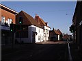
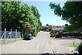
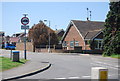
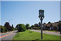
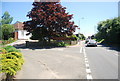
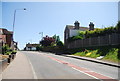
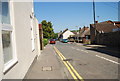
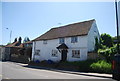
Photos of ME9 7LP


Area Information
ME9 7LP is a small residential postcode area in England, covering just 1.4 hectares and home to around 2050 people. With a population density of 584 people per square kilometre, it’s a compact, tightly knit community. The area’s modest size means it’s likely to feel quiet and intimate, with a strong sense of local identity. Residents here are predominantly adults aged 30–64, with a median age of 47, suggesting a mature, stable population. The area is largely owner-occupied, with 75% of homes owned by their residents, and most properties are houses rather than flats. This mix of demographics and housing types creates a balanced, low-pressure environment. Living in ME9 7LP offers proximity to essential amenities, including rail stations and retail outlets, while the low crime risk and absence of environmental constraints make it a practical choice for families and professionals seeking a calm, accessible location.
- Area Type
- Postcode
- Area Size
- 1.4 hectares
- Population
- 2050
- Population Density
- 584 people/km²
The property market in ME9 7LP is dominated by owner-occupied homes, with 75% of properties owned by residents rather than rented. The area’s housing stock consists primarily of houses, which suggests a focus on family-friendly living and space. Given the small size of the postcode area—just 1.4 hectares—the housing stock is likely limited, meaning buyers should consider the immediate surrounding areas for more options. The high home ownership rate indicates a stable market with fewer rental properties, which could make the area less attractive to investors but more appealing to those seeking long-term residency. Prospective buyers should also note that the compact nature of ME9 7LP means property availability may be constrained, requiring careful consideration of proximity to amenities and transport links.
House Prices in ME9 7LP
Showing 21 properties
| Address | Type | Beds | Baths | Last Sale Price | Last Sale Date | |
|---|---|---|---|---|---|---|
| 21 Brookes Place, Newington, ME9 7LP | Bungalow | 2 | 1 | £310,000 | Jul 2024 | |
| 14 Brookes Place, Newington, ME9 7LP | house | - | - | £480,000 | Sep 2021 | |
| 20 Brookes Place, Newington, ME9 7LP | Bungalow | 2 | - | £265,500 | Apr 2021 | |
| 19 Brookes Place, Newington, ME9 7LP | Detached | - | - | £401,000 | Aug 2019 | |
| 5 Brookes Place, Newington, ME9 7LP | Bungalow | 3 | 2 | £425,000 | Jun 2018 | |
| 3 Brookes Place, Newington, ME9 7LP | Terraced | 3 | 2 | £273,500 | Apr 2018 | |
| 2 Brookes Place, Newington, ME9 7LP | Terraced | 3 | - | £190,000 | May 2013 | |
| 9 Brookes Place, Newington, ME9 7LP | Bungalow | - | - | £273,000 | Dec 2012 | |
| 18 Brookes Place, Newington, ME9 7LP | Bungalow | 3 | - | £320,000 | May 2012 | |
| 15 Brookes Place, Newington, ME9 7LP | Detached | - | - | £425,000 | Jun 2008 |
Energy Efficiency in ME9 7LP
Living in ME9 7LP offers access to a mix of retail and transport hubs within practical reach. Nearby shops include Asda Sittingbourne, Co-op Grove, and Co-op Upchurch, providing essential grocery and retail services. These outlets support daily errands and convenience, reducing the need for long trips to larger centres. The area’s rail network, with stations at Newington, Rainham, and Sittingbourne, enhances mobility, allowing residents to travel easily for work, shopping, or leisure. While the data does not mention parks or leisure facilities, the presence of retail and rail amenities suggests a functional lifestyle, prioritising accessibility over expansive recreational spaces. The compact nature of the area means residents can access these amenities without significant travel time, contributing to a practical, low-stress daily routine.
Amenities
Schools
The nearest school to ME9 7LP is Newington Church of England Primary School, which serves the local community with a good Ofsted rating. This primary school is a key consideration for families, offering a reliable educational foundation for younger children. While the data does not include secondary schools, the presence of a well-rated primary institution suggests a focus on early education within the area. Families with children may need to look further afield for secondary schooling, but the availability of a good primary school is a significant advantage for those prioritising local education. The school’s rating indicates a commitment to quality teaching, which is essential for parents seeking a stable learning environment.
| Rank | School | Type | Entry gender | Ages |
|---|
Explore more schools in this area
Go to Schools tabDemographics
The community in ME9 7LP is characterised by a median age of 47, with the majority of residents falling within the 30–64 age range. This suggests a population that is largely in their prime working years, contributing to a stable local economy. Home ownership is high at 75%, indicating a settled, long-term resident base. The area is predominantly composed of houses, which aligns with the demographic profile of families and individuals seeking more space than flats can offer. The predominant ethnic group is White, reflecting a homogenous community. While no specific deprivation data is provided, the high home ownership rate and age profile imply a relatively secure quality of life, with fewer economic pressures compared to areas with higher rental occupancy or younger populations.
Household Size
Accommodation Type
Tenure
Ethnic Group
Religion
Household Composition
Age
Household Deprivation
NS-SEC
Explore more demographic insights in this area
Go to Demographics tabPlanning
Planning Constraints
- Flood RiskPremium
- Ramsar Wetland SitesPremium
- Area of Outstanding Natural BeautyPremium
- Protected Nature ReservePremium
- Protected WoodlandPremium