Area Overview for ME8 9SW
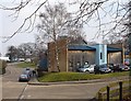
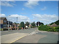
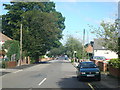
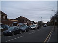
Photos of ME8 9SW


Area Information
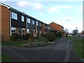
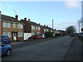
ME8 9SW is a small, tightly knit residential postcode area in England, home to 1,428 people. It is a compact cluster of homes, predominantly occupied by owners, reflecting a stable and long-term community. The area’s character is defined by its proximity to essential services and transport links, making it practical for everyday living. With a median age of 47 and a majority of residents aged 30–64, it is a mature community where families and established professionals coexist. Daily life here is shaped by nearby amenities, including retail outlets like Co-op Rainham and Morrisons Daily, and easy access to rail networks such as Rainham and Gillingham stations. The area’s digital connectivity is exceptional, with a broadband score of 100, ensuring seamless internet access for remote work or leisure. While it lacks natural landscapes like protected woodlands or wetlands, its safety profile is strong, with low crime and flood risks. ME8 9SW offers a blend of practicality and security, ideal for those prioritising stability and convenience.
- Area Type
- Postcode
- Area Size
- Not available
- Population
- 1428
- Population Density
- 6367 people/km²
ME8 9SW is primarily an owner-occupied area, with 81% of homes owned by residents rather than rented. This high ownership rate points to a community of long-term residents, many of whom have lived in the area for years. The accommodation type is predominantly houses, which is uncommon in more densely populated regions but typical of smaller, rural or semi-rural postcode areas. This means the housing stock is likely to include larger properties with gardens, appealing to families or those seeking space. However, the small size of the area—covering a single residential cluster—means the property market is limited in scale. Buyers should consider the proximity to nearby towns and amenities, as the immediate surroundings may offer more options for those seeking a wider range of property types. The focus on owner-occupation also suggests a stable market with less pressure from rental demand.
House Prices in ME8 9SW
No properties found in this postcode.
Energy Efficiency in ME8 9SW
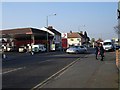
Residents of ME8 9SW have access to a range of practical amenities within easy reach. Local retail options include Co-op Rainham, Morrisons Daily, and M&S Medway, providing everyday shopping convenience. The area’s rail network is a key asset, with stations at Rainham, Gillingham, and Newington offering links to broader transport systems. For those needing regional travel, Rochester Airport is nearby, adding flexibility for trips beyond the local area. While the data does not mention parks or recreational spaces, the presence of retail and transport hubs suggests a lifestyle focused on accessibility and efficiency. The combination of shops, rail links, and airport access means daily life in ME8 9SW is streamlined, with minimal need to travel far for essentials. This makes it particularly appealing to those prioritising convenience and connectivity.
Amenities
Schools
| Rank | School | Type | Entry gender | Ages |
|---|
Explore more schools in this area
Go to Schools tabDemographics
The community in ME8 9SW is predominantly composed of adults aged 30–64, with a median age of 47. This suggests a mature population, likely with established careers and families. Home ownership is high, at 81%, indicating a preference for long-term residency over renting. The area is largely occupied by houses, with no data on flats or other property types. The predominant ethnic group is White, though no specific figures on diversity are provided. The population of 1,428 is small enough to foster a close-knit environment, where local amenities and transport links serve the needs of residents efficiently. The low crime score of 84/100 further supports a safe, stable living environment. For those considering ME8 9SW, the demographic profile suggests a community focused on stability, with minimal turnover and a strong sense of place.
Household Size
Accommodation Type
Tenure
Ethnic Group
Religion
Household Composition
Age
Household Deprivation
NS-SEC
Explore more demographic insights in this area
Go to Demographics tabPlanning
Planning Constraints
- Flood RiskPremium
- Ramsar Wetland SitesPremium
- Area of Outstanding Natural BeautyPremium
- Protected Nature ReservePremium
- Protected WoodlandPremium