Area Overview for ME8 9SH
Photos of ME8 9SH
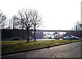

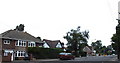

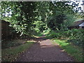

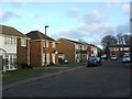
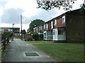
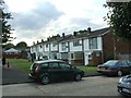
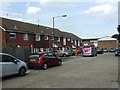
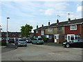
64 photos from this area
Area Information
Key information about the ME8 9SH including its size, population, and administrative classification.
- Area Type
- Postcode
- Area Size
- 2.1 hectares
- Population
- 1536
- Population Density
- 2846 people/km²
House Prices in ME8 9SH
63
Properties
£172,480
Average Sold Price
£57,000
Lowest Price
£305,000
Highest Price
Showing 63 properties
| Address | Type | Beds | Baths | Last Sale Price | Last Sale Date | |
|---|---|---|---|---|---|---|
| 56 Wollaston Close, Parkwood, Gillingham, ME8 9SH | Terraced | 2 | 1 | £250,000 | Nov 2025 | |
| 10 Wollaston Close, Parkwood, Gillingham, ME8 9SH | Flat | 2 | 1 | £165,000 | Jul 2024 | |
| 20 Wollaston Close, Parkwood, Gillingham, ME8 9SH | Flat | - | - | £178,000 | Dec 2023 | |
| 6 Wollaston Close, Parkwood, Gillingham, ME8 9SH | Terraced | 2 | 1 | £265,000 | Jul 2023 | |
| 8 Wollaston Close, Parkwood, Gillingham, ME8 9SH | house | 2 | 1 | £259,000 | May 2022 | |
| 59 Wollaston Close, Parkwood, Gillingham, ME8 9SH | house | 2 | - | £242,000 | Sep 2021 | |
| 62 Wollaston Close, Parkwood, Gillingham, ME8 9SH | Terraced | 3 | 1 | £305,000 | May 2021 | |
| 47 Wollaston Close, Parkwood, Gillingham, ME8 9SH | house | 2 | 1 | £220,000 | Mar 2021 | |
| 12 Wollaston Close, Parkwood, Gillingham, ME8 9SH | Flat | 2 | 1 | £153,000 | Feb 2021 | |
| 22 Wollaston Close, Parkwood, Gillingham, ME8 9SH | Flat | - | - | £155,000 | Dec 2020 |
Page 1 of 7
Energy Efficiency in ME8 9SH
Amenities
Schools
| Rank | School | Type | Entry gender | Ages |
|---|
Explore more schools in this area
Go to Schools tabDemographics
Household Size
Two person
most common
Accommodation Type
Houses
most common
Tenure
68
majority
Ethnic Group
White
most common
Religion
N/A
most common
Household Composition
N/A
most common
Age
47
median
Adults (30-64 years)
most common
Household Deprivation
N/A
with no deprivation
NS-SEC
31
in Lower managerial occupations
Explore more demographic insights in this area
Go to Demographics tabPlanning
Planning Constraints
- Flood RiskPremium
- Ramsar Wetland SitesPremium
- Area of Outstanding Natural BeautyPremium
- Protected Nature ReservePremium
- Protected WoodlandPremium