Area Overview for ME8 9HN
Photos of ME8 9HN
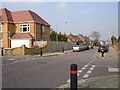
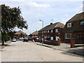
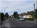
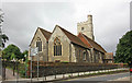


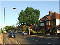
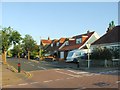
86 photos from this area
Area Information
Key information about the ME8 9HN including its size, population, and administrative classification.
- Area Type
- Postcode
- Area Size
- 9126 m²
- Population
- 1547
- Population Density
- 5811 people/km²
House Prices in ME8 9HN
29
Properties
£224,472
Average Sold Price
£64,500
Lowest Price
£365,000
Highest Price
Showing 29 properties
| Address | Type | Beds | Baths | Last Sale Price | Last Sale Date | |
|---|---|---|---|---|---|---|
| 9 Silverdale Drive, Rainham, Gillingham, ME8 9HN | house | 3 | 1 | £365,000 | Oct 2025 | |
| 18 Silverdale Drive, Rainham, Gillingham, ME8 9HN | Bungalow | 3 | 2 | £307,000 | Jan 2025 | |
| 16 Silverdale Drive, Rainham, Gillingham, ME8 9HN | Bungalow | - | - | £320,000 | Mar 2021 | |
| 2 Silverdale Drive, Rainham, Gillingham, ME8 9HN | house | - | - | £160,000 | Sep 2020 | |
| 33 Silverdale Drive, Rainham, Gillingham, ME8 9HN | house | 3 | 1 | £310,000 | Jul 2020 | |
| 15 Silverdale Drive, Rainham, Gillingham, ME8 9HN | house | - | - | £315,000 | Jul 2018 | |
| 2B Silverdale Drive, Rainham, Gillingham, ME8 9HN | house | - | - | £247,500 | Jul 2017 | |
| 4 Silverdale Drive, Rainham, Gillingham, ME8 9HN | Bungalow | - | - | £265,000 | Apr 2017 | |
| 12 Silverdale Drive, Rainham, Gillingham, ME8 9HN | Bungalow | - | - | £270,000 | Oct 2016 | |
| 27 Silverdale Drive, Rainham, Gillingham, ME8 9HN | Semi-detached | 3 | 1 | £210,000 | Mar 2015 |
Page 1 of 3
Energy Efficiency in ME8 9HN
Amenities
Schools
| Rank | School | Type | Entry gender | Ages |
|---|
Explore more schools in this area
Go to Schools tabDemographics
Household Size
Two person
most common
Accommodation Type
Houses
most common
Tenure
76
majority
Ethnic Group
White
most common
Religion
N/A
most common
Household Composition
N/A
most common
Age
47
median
Adults (30-64 years)
most common
Household Deprivation
N/A
with no deprivation
NS-SEC
35
in Lower managerial occupations
Explore more demographic insights in this area
Go to Demographics tabPlanning
Planning Constraints
- Flood RiskPremium
- Ramsar Wetland SitesPremium
- Area of Outstanding Natural BeautyPremium
- Protected Nature ReservePremium
- Protected WoodlandPremium