Area Overview for ME8 8NF
Photos of ME8 8NF
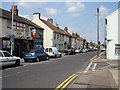


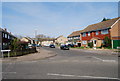


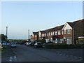
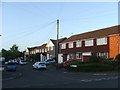
92 photos from this area
Area Information
Key information about the ME8 8NF including its size, population, and administrative classification.
- Area Type
- Postcode
- Area Size
- 6019 m²
- Population
- 1340
- Population Density
- 2269 people/km²
House Prices in ME8 8NF
15
Properties
£195,992
Average Sold Price
£59,950
Lowest Price
£356,000
Highest Price
Showing 15 properties
| Address | Type | Beds | Baths | Last Sale Price | Last Sale Date | |
|---|---|---|---|---|---|---|
| 115 Otterham Quay Lane, Rainham, Gillingham, ME8 8NF | house | 3 | 1 | £356,000 | Nov 2022 | |
| 111 Otterham Quay Lane, Rainham, Gillingham, ME8 8NF | Detached | 3 | 2 | £265,000 | Apr 2019 | |
| 107 Otterham Quay Lane, Rainham, Gillingham, ME8 8NF | house | - | - | £255,000 | Dec 2017 | |
| 99 Otterham Quay Lane, Rainham, Gillingham, ME8 8NF | house | - | - | £155,000 | Jul 2014 | |
| 119 Otterham Quay Lane, Rainham, Gillingham, ME8 8NF | Terraced | 2 | - | £205,000 | Jun 2013 | |
| 103 Otterham Quay Lane, Rainham, Gillingham, ME8 8NF | Detached | 3 | - | £75,995 | Nov 1999 | |
| 105 Otterham Quay Lane, Rainham, Gillingham, ME8 8NF | Terraced | 3 | - | £59,950 | Jan 1995 | |
| 113 Otterham Quay Lane, Rainham, Gillingham, ME8 8NF | Terraced | 2 | - | - | - | |
| 101 Otterham Quay Lane, Rainham, Gillingham, ME8 8NF | Terraced | 2 | - | - | - | |
| 109 Otterham Quay Lane, Rainham, Gillingham, ME8 8NF | Semi-detached | 3 | - | - | - |
Page 1 of 2
Energy Efficiency in ME8 8NF
Amenities
Schools
| Rank | School | Type | Entry gender | Ages |
|---|
Explore more schools in this area
Go to Schools tabDemographics
Household Size
Family (3-5 people)
most common
Accommodation Type
Houses
most common
Tenure
78
majority
Ethnic Group
White
most common
Religion
N/A
most common
Household Composition
N/A
most common
Age
47
median
Adults (30-64 years)
most common
Household Deprivation
N/A
with no deprivation
NS-SEC
37
in Lower managerial occupations
Explore more demographic insights in this area
Go to Demographics tabPlanning
Planning Constraints
- Flood RiskPremium
- Ramsar Wetland SitesPremium
- Area of Outstanding Natural BeautyPremium
- Protected Nature ReservePremium
- Protected WoodlandPremium