Area Overview for ME8 7UZ
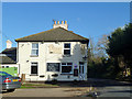
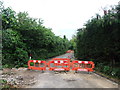
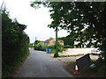
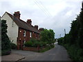
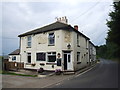
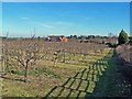
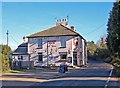
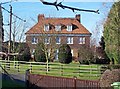
Photos of ME8 7UZ
Area Information
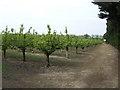
Living in ME8 7UZ means inhabiting a small, tightly knit residential cluster in England’s southeast. With a population of 1,360 and a density of 121 people per square kilometre, this area strikes a balance between quiet living and accessible amenities. The postcode covers a compact stretch of housing, likely centred around traditional homes rather than high-density developments. Its proximity to rail networks and retail hubs suggests a practical, commuter-friendly lifestyle. Residents benefit from nearby shops, including Co-op Upchurch and Tesco Rainham, while rail stations like Rainham and Gillingham offer direct links to larger towns. The area’s low flood risk and absence of protected natural sites indicate a straightforward, low-maintenance environment. For those seeking a community with a manageable population and minimal environmental constraints, ME8 7UZ offers a stable backdrop for daily life, with a focus on local convenience over sprawling urban sprawl.
- Area Type
- Postcode
- Area Size
- Not available
- Population
- 1360
- Population Density
- 121 people/km²
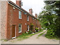
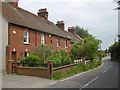
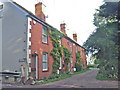
The property market in ME8 7UZ is overwhelmingly owner-occupied, with 92% of homes owned by residents rather than rented. This suggests a strong local attachment to property and limited availability of rental options. The accommodation type is exclusively houses, which is unusual for areas with higher population densities. This housing stock likely includes semi-detached or terraced homes, typical of smaller residential clusters. The small size of the area means the housing stock is finite, potentially limiting new developments. For buyers, this creates a market where properties are likely to be well-maintained and reflect the preferences of long-term residents. However, the limited scope for expansion means buyers should consider the area’s small footprint when assessing long-term value or future growth.
House Prices in ME8 7UZ
No properties found in this postcode.
Energy Efficiency in ME8 7UZ
Daily life in ME8 7UZ is shaped by its accessible amenities. Retail options include Co-op Upchurch, Asda Rainham High, and Tesco Rainham, offering a range of shopping needs within easy reach. The five nearby rail stations—Rainham, Newington, and Gillingham—provide frequent connections to surrounding towns, making commuting straightforward. Rochester Airport, though not within walking distance, is a short journey away, adding to the area’s transport versatility. While parks or leisure facilities are not explicitly listed in the data, the absence of protected natural sites suggests a focus on residential rather than recreational infrastructure. The area’s character is defined by its practicality: residents can meet daily needs locally while maintaining links to broader regional networks.
Amenities
Schools
| Rank | School | Type | Entry gender | Ages |
|---|
Explore more schools in this area
Go to Schools tabDemographics
The community in ME8 7UZ is predominantly composed of adults aged 30–64, with a median age of 47. This suggests a mature, established population, likely with long-term ties to the area. Home ownership is exceptionally high at 92%, reflecting a strong preference for private property over rental accommodation. The accommodation type is almost entirely houses, which aligns with the area’s low population density and residential character. The predominant ethnic group is White, though specific diversity metrics are not provided. The absence of detailed deprivation data means the quality of life remains unquantified, but the high home ownership and age profile imply a stable, settled demographic. For buyers, this indicates a community with fewer transient residents and a focus on long-term living.
Household Size
Accommodation Type
Tenure
Ethnic Group
Religion
Household Composition
Age
Household Deprivation
NS-SEC
Explore more demographic insights in this area
Go to Demographics tabPlanning
Planning Constraints
- Flood RiskPremium
- Ramsar Wetland SitesPremium
- Area of Outstanding Natural BeautyPremium
- Protected Nature ReservePremium
- Protected WoodlandPremium