Area Overview for ME8 7PT
Photos of ME8 7PT
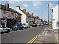


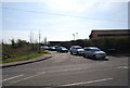
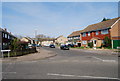
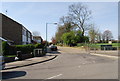
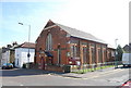
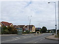
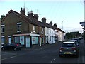
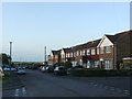
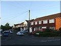
92 photos from this area
Area Information
Key information about the ME8 7PT including its size, population, and administrative classification.
- Area Type
- Postcode
- Area Size
- 1.0 hectares
- Population
- 1578
- Population Density
- 1894 people/km²
House Prices in ME8 7PT
51
Properties
£170,114
Average Sold Price
£43,500
Lowest Price
£280,000
Highest Price
Showing 51 properties
| Address | Type | Beds | Baths | Last Sale Price | Last Sale Date | |
|---|---|---|---|---|---|---|
| 258 Station Road, Rainham, Gillingham, ME8 7PT | Terraced | 2 | 2 | £267,000 | Nov 2025 | |
| 248 Station Road, Rainham, Gillingham, ME8 7PT | Semi-detached | 3 | 1 | £260,000 | Apr 2025 | |
| 281 Station Road, Rainham, Gillingham, ME8 7PT | house | 2 | 1 | £280,000 | Feb 2025 | |
| 291 Station Road, Rainham, Gillingham, ME8 7PT | Terraced | 3 | - | £190,000 | Aug 2024 | |
| 256 Station Road, Rainham, Gillingham, ME8 7PT | Terraced | 3 | 3 | £154,000 | Feb 2024 | |
| 267 Station Road, Rainham, Gillingham, ME8 7PT | Terraced | 2 | 2 | £265,000 | Aug 2023 | |
| 289 Station Road, Rainham, Gillingham, ME8 7PT | house | - | - | £247,000 | Aug 2021 | |
| 283 Station Road, Rainham, Gillingham, ME8 7PT | Semi-detached | 3 | 1 | £250,000 | Jul 2021 | |
| 305 Station Road, Rainham, Gillingham, ME8 7PT | house | 2 | 1 | £227,000 | May 2021 | |
| 268 Station Road, Rainham, Gillingham, ME8 7PT | Terraced | 2 | 1 | £152,000 | Mar 2017 |
Page 1 of 6
Energy Efficiency in ME8 7PT
Amenities
Schools
| Rank | School | Type | Entry gender | Ages |
|---|
Explore more schools in this area
Go to Schools tabDemographics
Household Size
Two person
most common
Accommodation Type
Houses
most common
Tenure
83
majority
Ethnic Group
White
most common
Religion
N/A
most common
Household Composition
N/A
most common
Age
47
median
Adults (30-64 years)
most common
Household Deprivation
N/A
with no deprivation
NS-SEC
35
in Lower managerial occupations
Explore more demographic insights in this area
Go to Demographics tabPlanning
Planning Constraints
- Flood RiskPremium
- Ramsar Wetland SitesPremium
- Area of Outstanding Natural BeautyPremium
- Protected Nature ReservePremium
- Protected WoodlandPremium