Area Overview for ME8 7NS
Photos of ME8 7NS
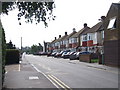
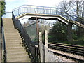
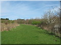
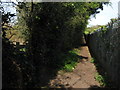
100 photos from this area
Area Information
Key information about the ME8 7NS including its size, population, and administrative classification.
- Area Type
- Postcode
- Area Size
- 6661 m²
- Population
- 1812
- Population Density
- 373 people/km²
House Prices in ME8 7NS
18
Properties
£261,445
Average Sold Price
£149,950
Lowest Price
£425,000
Highest Price
Showing 18 properties
| Address | Type | Beds | Baths | Last Sale Price | Last Sale Date | |
|---|---|---|---|---|---|---|
| 17 Broomcroft Road, Rainham, Gillingham, ME8 7NS | Semi-detached | 3 | 2 | £425,000 | Apr 2025 | |
| 11 Broomcroft Road, Rainham, Gillingham, ME8 7NS | Bungalow | - | - | £350,000 | Jan 2025 | |
| 33 Broomcroft Road, Rainham, Gillingham, ME8 7NS | Bungalow | 3 | - | £325,000 | May 2017 | |
| 28 Broomcroft Road, Rainham, Gillingham, ME8 7NS | Bungalow | - | - | £300,000 | Jun 2016 | |
| 26 Broomcroft Road, Rainham, Gillingham, ME8 7NS | Bungalow | 3 | - | £245,000 | Feb 2013 | |
| 24 Broomcroft Road, Rainham, Gillingham, ME8 7NS | Bungalow | 2 | - | £214,000 | Aug 2011 | |
| 22 Broomcroft Road, Rainham, Gillingham, ME8 7NS | Bungalow | 2 | 2 | £235,500 | Jun 2007 | |
| 13 Broomcroft Road, Rainham, Gillingham, ME8 7NS | Bungalow | 2 | 1 | £204,995 | May 2007 | |
| 15 Broomcroft Road, Rainham, Gillingham, ME8 7NS | Semi-detached | - | - | £165,000 | Feb 2003 | |
| 30 Broomcroft Road, Rainham, Gillingham, ME8 7NS | Semi-detached | - | - | £149,950 | Jan 2002 |
Page 1 of 2
Energy Efficiency in ME8 7NS
Amenities
Schools
| Rank | School | Type | Entry gender | Ages |
|---|
Explore more schools in this area
Go to Schools tabDemographics
Household Size
Two person
most common
Accommodation Type
Houses
most common
Tenure
91
majority
Ethnic Group
White
most common
Religion
N/A
most common
Household Composition
N/A
most common
Age
47
median
Adults (30-64 years)
most common
Household Deprivation
N/A
with no deprivation
NS-SEC
38
in Lower managerial occupations
Explore more demographic insights in this area
Go to Demographics tabPlanning
Planning Constraints
- Flood RiskPremium
- Ramsar Wetland SitesPremium
- Area of Outstanding Natural BeautyPremium
- Protected Nature ReservePremium
- Protected WoodlandPremium