Area Overview for ME8 6AB
Photos of ME8 6AB


Area Information
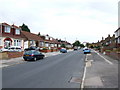
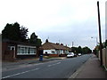
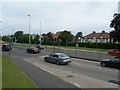
ME8 6AB is a small residential postcode area in England, home to just 1,648 people. It is a compact cluster of homes, predominantly occupied by owners, with a median age of 47. The area’s character is defined by its stability and low population density, offering a quiet, community-focused environment. Daily life here is shaped by proximity to essential services and transport links. Residents benefit from nearby schools, including both primary and special educational institutions, and a network of railway stations that connect to major towns. The area’s digital infrastructure is robust, with a broadband score of 100 and mobile coverage rated as good. While it lacks natural landscapes like AONBs or protected woodlands, its safety profile is strong, with a crime risk score of 71. Living in ME8 6AB suits those seeking a balanced lifestyle with practical amenities, minimal environmental constraints, and a sense of security. Homes in ME8 6AB are primarily owner-occupied, reflecting a stable local economy and long-term residency.
- Area Type
- Postcode
- Area Size
- Not available
- Population
- 1648
- Population Density
- 5677 people/km²
The property market in ME8 6AB is dominated by owner-occupied homes, with 81% of properties in private ownership. This suggests a stable market with limited rental activity, likely reflecting the area’s appeal to long-term residents. The accommodation type is primarily houses, which are more common than flats or apartments. This housing stock may cater to families or individuals seeking space and privacy. Given the small size of the area, property availability is limited, and buyers should consider nearby suburbs for broader options. The high home ownership rate indicates strong local demand, but the lack of specific price data means the market’s competitiveness is unclear. For those seeking a home in ME8 6AB, the focus is on securing a property in a low-risk, well-connected environment.
House Prices in ME8 6AB
No properties found in this postcode.
Energy Efficiency in ME8 6AB
The lifestyle in ME8 6AB is shaped by its proximity to retail and transport hubs. Nearby shops include Iceland Twydall, Aldi Twydall, and Tesco Gillingham, offering everyday essentials. The area’s rail links provide access to broader leisure and employment opportunities, while Rochester Airport caters to occasional travel needs. Though the postcode itself is small, the surrounding area includes a network of stations and retail outlets, enhancing convenience. The absence of major parks or leisure facilities within the postcode means residents may need to travel slightly further for recreational activities. However, the practical reach of amenities ensures a functional daily life, with a focus on efficiency over sprawling urban sprawl.
Amenities
Schools
Residents of ME8 6AB have access to several educational institutions, including Featherby Infant and Nursery School, which serves primary-aged children, and Danecourt Community School and Danecourt School, both special needs institutions. The presence of both mainstream and special schools offers families flexibility, though the absence of secondary schools may require commuting. The area’s schools are likely to cater to a range of educational needs, including those with additional support requirements. While no Ofsted ratings are provided, the variety of school types suggests a commitment to inclusive education. For families, the proximity of these schools is a practical advantage, reducing travel time and supporting a balanced lifestyle.
| Rank | School | Type | Entry gender | Ages |
|---|
Explore more schools in this area
Go to Schools tabDemographics
The community in ME8 6AB is predominantly composed of adults aged 30–64, with a median age of 47. Home ownership is high, at 81%, indicating a long-term presence of residents. The area is characterised by houses rather than flats, suggesting a mix of family homes and single-occupancy properties. The predominant ethnic group is White, though specific diversity metrics are not provided. The age profile suggests a mature population, likely with established careers and family ties. This demographic structure may influence local services and amenities, with a focus on stability over transient needs. The absence of detailed deprivation data means the area’s quality of life is inferred from its safety, connectivity, and infrastructure. For buyers, this profile suggests a community prioritising security and continuity over rapid change.
Household Size
Accommodation Type
Tenure
Ethnic Group
Religion
Household Composition
Age
Household Deprivation
NS-SEC
Explore more demographic insights in this area
Go to Demographics tabPlanning
Planning Constraints
- Flood RiskPremium
- Ramsar Wetland SitesPremium
- Area of Outstanding Natural BeautyPremium
- Protected Nature ReservePremium
- Protected WoodlandPremium