Area Overview for ME8 0TL
Photos of ME8 0TL

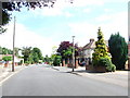

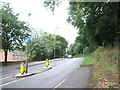


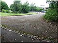
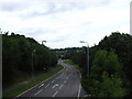
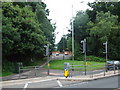
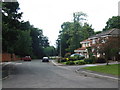

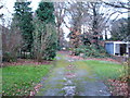
100 photos from this area
Area Information
Key information about the ME8 0TL including its size, population, and administrative classification.
- Area Type
- Postcode
- Area Size
- 2.8 hectares
- Population
- 1579
- Population Density
- 2829 people/km²
House Prices in ME8 0TL
19
Properties
£332,349
Average Sold Price
£67,000
Lowest Price
£730,000
Highest Price
Showing 19 properties
| Address | Type | Beds | Baths | Last Sale Price | Last Sale Date | |
|---|---|---|---|---|---|---|
| 192 Wigmore Road, Wigmore, Gillingham, ME8 0TL | Detached | 4 | 1 | £535,000 | Jun 2025 | |
| 198 Wigmore Road, Wigmore, Gillingham, ME8 0TL | house | - | - | £437,534 | Nov 2021 | |
| 202 Wigmore Road, Wigmore, Gillingham, ME8 0TL | house | - | - | £730,000 | Sep 2021 | |
| 175 Wigmore Road, Wigmore, Gillingham, ME8 0TL | Bungalow | - | - | £350,000 | May 2015 | |
| 190 Wigmore Road, Wigmore, Gillingham, ME8 0TL | Detached | 3 | - | £336,000 | Sep 2014 | |
| 179 Wigmore Road, Wigmore, Gillingham, ME8 0TL | Detached | - | - | £315,000 | Aug 2014 | |
| 189 Wigmore Road, Wigmore, Gillingham, ME8 0TL | Detached | - | - | £280,000 | Mar 2007 | |
| 183 Wigmore Road, Wigmore, Gillingham, ME8 0TL | Detached | - | - | £330,000 | Nov 2006 | |
| 185 Wigmore Road, Wigmore, Gillingham, ME8 0TL | Detached | - | - | £375,000 | Nov 2005 | |
| 193 Wigmore Road, Wigmore, Gillingham, ME8 0TL | Detached | - | - | £220,000 | Oct 2005 |
Page 1 of 2
Energy Efficiency in ME8 0TL
Amenities
Schools
| Rank | School | Type | Entry gender | Ages |
|---|
Explore more schools in this area
Go to Schools tabDemographics
Household Size
Two person
most common
Accommodation Type
Houses
most common
Tenure
89
majority
Ethnic Group
White
most common
Religion
N/A
most common
Household Composition
N/A
most common
Age
47
median
Adults (30-64 years)
most common
Household Deprivation
N/A
with no deprivation
NS-SEC
39
in Lower managerial occupations
Explore more demographic insights in this area
Go to Demographics tabPlanning
Planning Constraints
- Flood RiskPremium
- Ramsar Wetland SitesPremium
- Area of Outstanding Natural BeautyPremium
- Protected Nature ReservePremium
- Protected WoodlandPremium