Area Overview for ME8 0QA
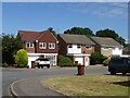
Photos of ME8 0QA


Area Information
Living in ME8 0QA means being part of a tightly knit residential cluster in England’s southeast, where 1,505 people reside across a compact area. With a population density of 1,481 people per square kilometre, this postcode reflects a community that values proximity to amenities and transport links. The area’s small size means neighbours are likely to know each other, fostering a sense of familiarity. Residents benefit from nearby retail options, including Aldi Twydall, Iceland Twydall, and Tesco Gillingham, which cater to daily needs. The presence of multiple railway stations—Rainham, Gillingham, and Chatham—ensures easy access to commuting routes, while Rochester Airport provides a direct link to regional travel. ME8 0QA is not a sprawling suburb but a focused, practical locale where convenience and connectivity are prioritised. Its character is defined by modest housing stock, a mature demographic, and a balance between residential tranquility and accessibility to urban services. For buyers, this area offers a snapshot of suburban living with a focus on functional, well-serviced homes.
- Area Type
- Postcode
- Area Size
- Not available
- Population
- 1505
- Population Density
- 1481 people/km²
ME8 0QA is a predominantly owner-occupied area, with 88% of homes owned by residents rather than rented. The housing stock is largely composed of houses, which is unusual for areas with higher population densities but aligns with the postcode’s small, clustered layout. This suggests a market where properties are likely to be family homes or long-term investments rather than short-term rentals. The focus on houses may mean limited availability of flats or apartments, which could be a consideration for buyers seeking different property types. Given the area’s compact size, the immediate surroundings are likely to mirror this pattern, with little variation in housing styles. For buyers, the high home ownership rate indicates a stable market, but the limited property diversity may require looking further afield for alternative options.
House Prices in ME8 0QA
No properties found in this postcode.
Energy Efficiency in ME8 0QA
Daily life in ME8 0QA is shaped by its proximity to essential amenities. The area’s retail offerings include Aldi Twydall, Iceland Twydall, and Tesco Gillingham, providing a range of grocery and household goods within walking or short driving distance. While not a shopping destination in itself, the postcode benefits from these nearby stores, which serve both residents and surrounding communities. The presence of multiple railway stations—Rainham, Gillingham, and Chatham—adds to the area’s practicality, enabling easy access to employment, leisure, and transport networks. Rochester Airport further enhances connectivity for those requiring regional travel. Though the data does not mention parks or leisure facilities, the area’s compact layout suggests a focus on functional living rather than expansive recreational spaces. Overall, ME8 0QA offers a lifestyle that prioritises convenience and accessibility over sprawling amenities.
Amenities
Schools
| Rank | School | Type | Entry gender | Ages |
|---|
Explore more schools in this area
Go to Schools tabDemographics
The community in ME8 0QA is predominantly composed of adults aged 30–64, with a median age of 47. This suggests a population that is largely settled, with many likely to be in their prime working years or approaching retirement. Home ownership is high at 88%, indicating a stable, long-term resident base rather than a transient rental market. The accommodation type is primarily houses, which aligns with the area’s residential character and suggests a preference for private, standalone properties. The predominant ethnic group is White, reflecting the broader demographic trends of the region. While no specific data on deprivation is provided, the high home ownership rate and mature age profile imply a relatively stable economic environment. However, the absence of detailed diversity metrics means the full scope of the community’s social composition remains unexplored.
Household Size
Accommodation Type
Tenure
Ethnic Group
Religion
Household Composition
Age
Household Deprivation
NS-SEC
Explore more demographic insights in this area
Go to Demographics tabPlanning
Planning Constraints
- Flood RiskPremium
- Ramsar Wetland SitesPremium
- Area of Outstanding Natural BeautyPremium
- Protected Nature ReservePremium
- Protected WoodlandPremium