Area Overview for ME8 0LD
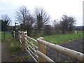
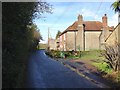
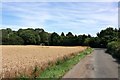
Photos of ME8 0LD


Area Information
ME8 0LD is a small, tightly knit residential postcode in England, home to 1,536 residents. The area’s compact size fosters a quiet, community-focused atmosphere, with homes predominantly occupied by adults aged 30–64, reflecting a mature demographic. This is a place where daily life revolves around local amenities and established routines. The postcode’s proximity to Rainham and surrounding villages offers a balance of rural tranquillity and accessible services. Residents benefit from excellent broadband connectivity, scoring 100 out of 100, ensuring seamless internet use for work or leisure. Nearby, the St Augustine of Canterbury Catholic Primary School provides a solid foundation for families with young children. While the area lacks major urban hubs, its small size means residents are close to essential services, including retail outlets and rail links. The low flood risk and absence of protected natural sites make it a practical choice for those seeking a stable, low-maintenance living environment.
- Area Type
- Postcode
- Area Size
- Not available
- Population
- 1536
- Population Density
- 2846 people/km²
ME8 0LD is characterised by a high proportion of owner-occupied homes, with 68% of properties owned by residents rather than rented. This suggests a stable market with limited turnover, as the area’s small size means housing stock is finite. The accommodation type is predominantly houses, which contrasts with areas dominated by flats or apartments. For buyers, this implies a focus on family homes with gardens, likely in semi-detached or detached styles. The limited number of properties means competition may be fierce, particularly for those seeking specific features. Given the area’s low crime risk and good connectivity, it appeals to those prioritising safety and practicality over investment potential. Buyers should consider the proximity to rail links and schools when evaluating property value.
House Prices in ME8 0LD
No properties found in this postcode.
Energy Efficiency in ME8 0LD
ME8 0LD’s lifestyle is defined by its accessible amenities and small-community charm. Within practical reach are five retail outlets, including Sainsburys Hempstead, M&S Hempstead, and Co-op Rainham, offering everyday shopping needs. The area’s rail links provide easy access to nearby towns and cities, while Rochester Airport adds regional travel convenience. Though the data does not specify parks or leisure facilities, the absence of planning constraints like AONBs or protected woodlands suggests open spaces may be available nearby. The mix of retail, transport, and proximity to a primary school creates a self-contained environment, ideal for those valuing convenience without urban density. Residents can enjoy a balance of local services and the ability to commute further afield.
Amenities
Schools
The nearest school to ME8 0LD is St Augustine of Canterbury Catholic Primary School, a primary institution with an Ofsted rating of ‘good’. This provides a reliable option for families with young children, though no secondary schools are listed in the data. The presence of a primary school within reach suggests the area is well-suited for families requiring immediate educational infrastructure. However, residents seeking secondary education may need to travel to nearby towns. The school’s rating indicates a standard of teaching and facilities that meet expectations, though specific details on curriculum or extracurriculars are not provided. For parents, the proximity of this school is a practical advantage, reducing commuting time and supporting a child’s early education.
| Rank | School | Type | Entry gender | Ages |
|---|
Explore more schools in this area
Go to Schools tabDemographics
ME8 0LD has a median age of 47, with the majority of residents falling within the 30–64 age range. This suggests a community of established professionals and families, rather than a younger or elderly population. Home ownership is high, at 68%, indicating a strong presence of long-term residents. The area is predominantly occupied by houses, reflecting a traditional, suburban layout. The predominant ethnic group is White, which aligns with broader regional patterns. The absence of specific data on deprivation means the quality of life can be inferred from the low crime risk and robust infrastructure. With no significant age groups under 18 or over 65 noted, the area is well-suited for those prioritising stability over dynamic, multi-generational living.
Household Size
Accommodation Type
Tenure
Ethnic Group
Religion
Household Composition
Age
Household Deprivation
NS-SEC
Explore more demographic insights in this area
Go to Demographics tabPlanning
Planning Constraints
- Flood RiskPremium
- Ramsar Wetland SitesPremium
- Area of Outstanding Natural BeautyPremium
- Protected Nature ReservePremium
- Protected WoodlandPremium