Area Overview for ME8 0JG
Photos of ME8 0JG
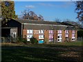
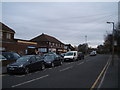
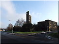
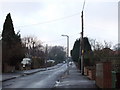
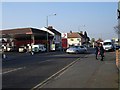
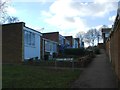
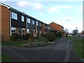
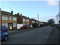
89 photos from this area
Area Information
Key information about the ME8 0JG including its size, population, and administrative classification.
- Area Type
- Postcode
- Area Size
- 2.1 hectares
- Population
- 1631
- Population Density
- 2905 people/km²
House Prices in ME8 0JG
33
Properties
£363,681
Average Sold Price
£85,000
Lowest Price
£765,000
Highest Price
Showing 33 properties
| Address | Type | Beds | Baths | Last Sale Price | Last Sale Date | |
|---|---|---|---|---|---|---|
| 17 Springvale, Rainham, Gillingham, ME8 0JG | Bungalow | 3 | 2 | £500,000 | Apr 2024 | |
| 41 Springvale, Rainham, Gillingham, ME8 0JG | house | 3 | - | £765,000 | Sep 2023 | |
| 21 Springvale, Rainham, Gillingham, ME8 0JG | Detached | 5 | 3 | £275,000 | May 2022 | |
| 33 Springvale, Rainham, Gillingham, ME8 0JG | house | - | - | £382,500 | Aug 2021 | |
| 11 Springvale, Rainham, Gillingham, ME8 0JG | Detached | 5 | 3 | £550,000 | Feb 2021 | |
| 23 Springvale, Rainham, Gillingham, ME8 0JG | Detached | 5 | 2 | £605,000 | Feb 2021 | |
| 30 Springvale, Rainham, Gillingham, ME8 0JG | Detached | 5 | 4 | £613,800 | Oct 2018 | |
| 27 Springvale, Rainham, Gillingham, ME8 0JG | Bungalow | - | - | £530,000 | Dec 2015 | |
| 1 Springvale, Rainham, Gillingham, ME8 0JG | Detached | 4 | 1 | £285,000 | May 2015 | |
| 22 Springvale, Rainham, Gillingham, ME8 0JG | Bungalow | 2 | 1 | £269,000 | Feb 2015 |
Page 1 of 4
Energy Efficiency in ME8 0JG
Amenities
Schools
| Rank | School | Type | Entry gender | Ages |
|---|
Explore more schools in this area
Go to Schools tabDemographics
Household Size
Two person
most common
Accommodation Type
Houses
most common
Tenure
90
majority
Ethnic Group
White
most common
Religion
N/A
most common
Household Composition
N/A
most common
Age
47
median
Adults (30-64 years)
most common
Household Deprivation
N/A
with no deprivation
NS-SEC
38
in Lower managerial occupations
Explore more demographic insights in this area
Go to Demographics tabPlanning
Planning Constraints
- Flood RiskPremium
- Ramsar Wetland SitesPremium
- Area of Outstanding Natural BeautyPremium
- Protected Nature ReservePremium
- Protected WoodlandPremium