Area Overview for ME8 0EX
Photos of ME8 0EX
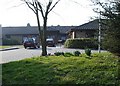

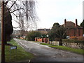
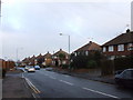
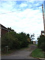
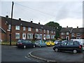
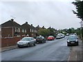
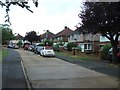
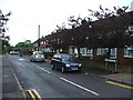
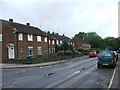
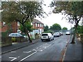
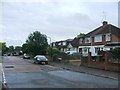
45 photos from this area
Area Information
Key information about the ME8 0EX including its size, population, and administrative classification.
- Area Type
- Postcode
- Area Size
- 8592 m²
- Population
- 1526
- Population Density
- 6249 people/km²
House Prices in ME8 0EX
18
Properties
£237,206
Average Sold Price
£65,000
Lowest Price
£465,000
Highest Price
Showing 18 properties
| Address | Type | Beds | Baths | Last Sale Price | Last Sale Date | |
|---|---|---|---|---|---|---|
| 245 Maidstone Road, Rainham, Gillingham, ME8 0EX | Detached | 3 | 1 | £400,000 | Dec 2025 | |
| 255 Maidstone Road, Rainham, Gillingham, ME8 0EX | Detached | 4 | 2 | £465,000 | Feb 2024 | |
| 251 Maidstone Road, Rainham, Gillingham, ME8 0EX | house | - | - | £345,000 | Jun 2021 | |
| 229 Maidstone Road, Rainham, Gillingham, ME8 0EX | Semi-detached | 3 | 1 | £360,000 | Jun 2020 | |
| 231 Maidstone Road, Rainham, Gillingham, ME8 0EX | Semi-detached | 3 | 1 | £340,000 | Nov 2019 | |
| 253 Maidstone Road, Rainham, Gillingham, ME8 0EX | Bungalow | 3 | 1 | £370,000 | Oct 2019 | |
| 235 Maidstone Road, Rainham, Gillingham, ME8 0EX | house | - | - | £185,000 | Aug 2010 | |
| 227 Maidstone Road, Rainham, Gillingham, ME8 0EX | Semi-detached | - | - | £194,995 | Jul 2005 | |
| 247 Maidstone Road, Rainham, Gillingham, ME8 0EX | Semi-detached | 3 | 1 | £198,000 | Jul 2004 | |
| 243 Maidstone Road, Rainham, Gillingham, ME8 0EX | Semi-detached | - | - | £193,000 | Mar 2004 |
Page 1 of 2
Energy Efficiency in ME8 0EX
Amenities
Schools
| Rank | School | Type | Entry gender | Ages |
|---|
Explore more schools in this area
Go to Schools tabDemographics
Household Size
Family (3-5 people)
most common
Accommodation Type
Houses
most common
Tenure
92
majority
Ethnic Group
White
most common
Religion
N/A
most common
Household Composition
N/A
most common
Age
47
median
Adults (30-64 years)
most common
Household Deprivation
N/A
with no deprivation
NS-SEC
36
in Lower managerial occupations
Explore more demographic insights in this area
Go to Demographics tabPlanning
Planning Constraints
- Flood RiskPremium
- Ramsar Wetland SitesPremium
- Area of Outstanding Natural BeautyPremium
- Protected Nature ReservePremium
- Protected WoodlandPremium