Area Overview for ME7 5UX
Photos of ME7 5UX
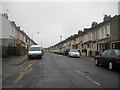
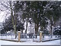


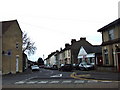
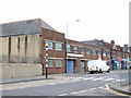
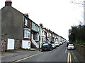
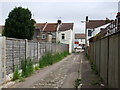
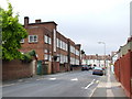
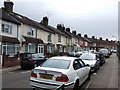
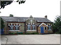
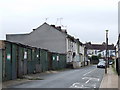
100 photos from this area
Area Information
Key information about the ME7 5UX including its size, population, and administrative classification.
- Area Type
- Postcode
- Area Size
- 3897 m²
- Population
- 1686
- Population Density
- 5594 people/km²
House Prices in ME7 5UX
14
Properties
£165,649
Average Sold Price
£50,000
Lowest Price
£220,000
Highest Price
Showing 14 properties
| Address | Type | Beds | Baths | Last Sale Price | Last Sale Date | |
|---|---|---|---|---|---|---|
| 8 Albert Road, Gillingham, ME7 5UX | Terraced | 3 | 1 | £220,000 | Feb 2025 | |
| 17 Albert Road, Gillingham, ME7 5UX | Bungalow | 1 | 1 | £220,000 | Sep 2023 | |
| 9 Albert Road, Gillingham, ME7 5UX | Detached | 2 | - | £220,000 | May 2023 | |
| 10 Albert Road, Gillingham, ME7 5UX | Terraced | 3 | 1 | £207,500 | Jan 2018 | |
| 1 Albert Road, Gillingham, ME7 5UX | Terraced | 3 | 1 | £200,000 | Sep 2017 | |
| 11 Albert Road, Gillingham, ME7 5UX | Bungalow | 2 | - | £184,995 | Jul 2016 | |
| 3 Albert Road, Gillingham, ME7 5UX | Terraced | 3 | - | £124,995 | Aug 2013 | |
| 6 Albert Road, Gillingham, ME7 5UX | house | - | - | £110,000 | Dec 2010 | |
| 5 Albert Road, Gillingham, ME7 5UX | Terraced | - | - | £119,000 | Aug 2004 | |
| 2 Albert Road, Gillingham, ME7 5UX | Terraced | - | - | £50,000 | Aug 2000 |
Page 1 of 2
Energy Efficiency in ME7 5UX
Amenities
Schools
| Rank | School | Type | Entry gender | Ages |
|---|
Explore more schools in this area
Go to Schools tabDemographics
Household Size
Family (3-5 people)
most common
Accommodation Type
Houses
most common
Tenure
57
majority
Ethnic Group
White
most common
Religion
N/A
most common
Household Composition
N/A
most common
Age
47
median
Adults (30-64 years)
most common
Household Deprivation
N/A
with no deprivation
NS-SEC
28
in Lower managerial occupations
Explore more demographic insights in this area
Go to Demographics tabPlanning
Planning Constraints
- Flood RiskPremium
- Ramsar Wetland SitesPremium
- Area of Outstanding Natural BeautyPremium
- Protected Nature ReservePremium
- Protected WoodlandPremium