Area Overview for ME7 5PS
Photos of ME7 5PS
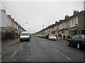
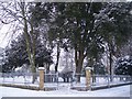


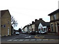
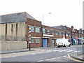
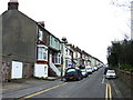
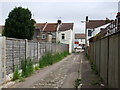
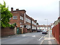
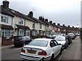
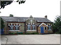
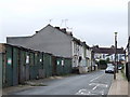
100 photos from this area
Area Information
Key information about the ME7 5PS including its size, population, and administrative classification.
- Area Type
- Postcode
- Area Size
- 6072 m²
- Population
- 1772
- Population Density
- 12831 people/km²
House Prices in ME7 5PS
35
Properties
£199,577
Average Sold Price
£49,500
Lowest Price
£367,000
Highest Price
Showing 35 properties
| Address | Type | Beds | Baths | Last Sale Price | Last Sale Date | |
|---|---|---|---|---|---|---|
| 104 Rock Avenue, Gillingham, ME7 5PS | Terraced | 3 | 2 | £307,000 | Jul 2024 | |
| 80 Rock Avenue, Gillingham, ME7 5PS | Terraced | 5 | 2 | £360,000 | Jul 2023 | |
| 84 Rock Avenue, Gillingham, ME7 5PS | Terraced | 3 | 1 | £367,000 | Mar 2023 | |
| 112 Rock Avenue, Gillingham, ME7 5PS | Terraced | 3 | - | £260,000 | Jul 2019 | |
| 110 Rock Avenue, Gillingham, ME7 5PS | Terraced | 3 | 1 | £210,000 | Nov 2015 | |
| 98 Rock Avenue, Gillingham, ME7 5PS | house | 3 | - | £150,000 | Dec 2011 | |
| St Lawrence Home, 78 Rock Avenue, Gillingham, ME7 5PS | house | - | - | £315,000 | May 2006 | |
| 88 Rock Avenue, Gillingham, ME7 5PS | Terraced | - | - | £220,000 | Feb 2006 | |
| 116 Rock Avenue, Gillingham, ME7 5PS | house | - | - | £95,000 | Jul 2002 | |
| 96 Rock Avenue, Gillingham, ME7 5PS | Terraced | 4 | 3 | £120,000 | Mar 2002 |
Page 1 of 4
Energy Efficiency in ME7 5PS
Amenities
Schools
| Rank | School | Type | Entry gender | Ages |
|---|
Explore more schools in this area
Go to Schools tabDemographics
Household Size
Family (3-5 people)
most common
Accommodation Type
Houses
most common
Tenure
49
majority
Ethnic Group
White
most common
Religion
N/A
most common
Household Composition
N/A
most common
Age
47
median
Adults (30-64 years)
most common
Household Deprivation
N/A
with no deprivation
NS-SEC
25
in Lower managerial occupations
Explore more demographic insights in this area
Go to Demographics tabPlanning
Planning Constraints
- Flood RiskPremium
- Ramsar Wetland SitesPremium
- Area of Outstanding Natural BeautyPremium
- Protected Nature ReservePremium
- Protected WoodlandPremium