Area Overview for ME7 4QH
Photos of ME7 4QH
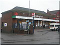

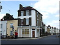
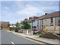
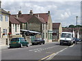
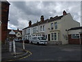
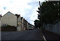
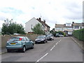
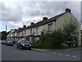
100 photos from this area
Area Information
Key information about the ME7 4QH including its size, population, and administrative classification.
- Area Type
- Postcode
- Area Size
- 5711 m²
- Population
- 1471
- Population Density
- 11035 people/km²
House Prices in ME7 4QH
36
Properties
£169,139
Average Sold Price
£42,995
Lowest Price
£300,000
Highest Price
Showing 36 properties
| Address | Type | Beds | Baths | Last Sale Price | Last Sale Date | |
|---|---|---|---|---|---|---|
| 213 Balmoral Road, Gillingham, ME7 4QH | Terraced | 3 | 1 | £260,000 | Apr 2025 | |
| 167 Balmoral Road, Gillingham, ME7 4QH | Terraced | 3 | 1 | £300,000 | Dec 2024 | |
| 161 Balmoral Road, Gillingham, ME7 4QH | house | 3 | 2 | £210,000 | Aug 2023 | |
| 197 Balmoral Road, Gillingham, ME7 4QH | house | 3 | 1 | £283,000 | Nov 2022 | |
| 211 Balmoral Road, Gillingham, ME7 4QH | house | - | - | £242,500 | Feb 2021 | |
| 191 Balmoral Road, Gillingham, ME7 4QH | house | - | - | £190,000 | Jan 2020 | |
| 185 Balmoral Road, Gillingham, ME7 4QH | Terraced | 3 | 2 | £155,000 | Feb 2019 | |
| 171 Balmoral Road, Gillingham, ME7 4QH | Terraced | 3 | 1 | £235,500 | Mar 2018 | |
| 215 Balmoral Road, Gillingham, ME7 4QH | Terraced | 3 | 1 | £205,000 | Jul 2016 | |
| 181 Balmoral Road, Gillingham, ME7 4QH | Terraced | 3 | 1 | £135,000 | Sep 2014 |
Page 1 of 4
Energy Efficiency in ME7 4QH
Amenities
Schools
| Rank | School | Type | Entry gender | Ages |
|---|
Explore more schools in this area
Go to Schools tabDemographics
Household Size
Family (3-5 people)
most common
Accommodation Type
Houses
most common
Tenure
54
majority
Ethnic Group
White
most common
Religion
N/A
most common
Household Composition
N/A
most common
Age
47
median
Adults (30-64 years)
most common
Household Deprivation
N/A
with no deprivation
NS-SEC
21
in Lower managerial occupations
Explore more demographic insights in this area
Go to Demographics tabPlanning
Planning Constraints
- Flood RiskPremium
- Ramsar Wetland SitesPremium
- Area of Outstanding Natural BeautyPremium
- Protected Nature ReservePremium
- Protected WoodlandPremium