Area Overview for ME7 4HP
Photos of ME7 4HP
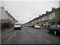
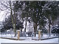


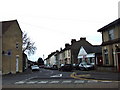
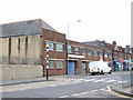
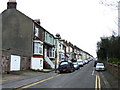
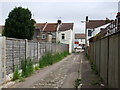
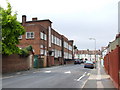
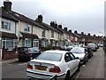
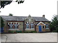
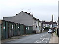
100 photos from this area
Area Information
Key information about the ME7 4HP including its size, population, and administrative classification.
- Area Type
- Postcode
- Area Size
- 9064 m²
- Population
- 1481
- Population Density
- 6981 people/km²
House Prices in ME7 4HP
53
Properties
£136,451
Average Sold Price
£38,000
Lowest Price
£292,000
Highest Price
Showing 53 properties
| Address | Type | Beds | Baths | Last Sale Price | Last Sale Date | |
|---|---|---|---|---|---|---|
| 47 Albany Road, Gillingham, ME7 4HP | house | - | - | £224,000 | Dec 2025 | |
| 41 Albany Road, Gillingham, ME7 4HP | house | 3 | 1 | £185,000 | Aug 2025 | |
| 39 Albany Road, Gillingham, ME7 4HP | Terraced | 4 | 1 | £218,000 | May 2024 | |
| 77 Albany Road, Gillingham, ME7 4HP | Terraced | 3 | 1 | £210,000 | Apr 2024 | |
| 54 Albany Road, Gillingham, ME7 4HP | Terraced | 3 | 1 | £215,000 | Feb 2024 | |
| 78 Albany Road, Gillingham, ME7 4HP | Terraced | 4 | 1 | £292,000 | Apr 2022 | |
| 57 Albany Road, Gillingham, ME7 4HP | house | - | - | £234,000 | Sep 2021 | |
| 63 Albany Road, Gillingham, ME7 4HP | house | - | - | £195,500 | Feb 2021 | |
| 79 Albany Road, Gillingham, ME7 4HP | Terraced | 3 | 1 | £177,000 | Nov 2020 | |
| 37 Albany Road, Gillingham, ME7 4HP | Flat | 2 | 1 | £182,000 | Jul 2020 |
Page 1 of 6
Energy Efficiency in ME7 4HP
Amenities
Schools
| Rank | School | Type | Entry gender | Ages |
|---|
Explore more schools in this area
Go to Schools tabDemographics
Household Size
Family (3-5 people)
most common
Accommodation Type
Houses
most common
Tenure
74
majority
Ethnic Group
White
most common
Religion
N/A
most common
Household Composition
N/A
most common
Age
47
median
Adults (30-64 years)
most common
Household Deprivation
N/A
with no deprivation
NS-SEC
32
in Lower managerial occupations
Explore more demographic insights in this area
Go to Demographics tabPlanning
Planning Constraints
- Flood RiskPremium
- Ramsar Wetland SitesPremium
- Area of Outstanding Natural BeautyPremium
- Protected Nature ReservePremium
- Protected WoodlandPremium