Area Overview for ME7 3NQ
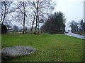
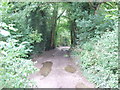
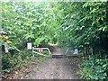
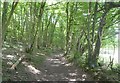
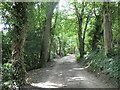
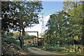
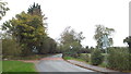
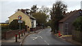
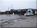
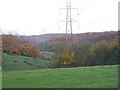
Photos of ME7 3NQ


Area Information
ME7 3NQ is a small residential cluster in England, home to 1,695 people spread across a low-density area with 85 people per square kilometre. This postcode area reflects a quiet, settled community, with a median age of 47 and a population skewed toward adults aged 30–64. The area is predominantly owner-occupied, with 85% of homes owned by residents, and most properties are houses rather than flats. Living here means a slower pace of life, with proximity to local amenities and transport links. The area’s compact size ensures a close-knit feel, though it remains well-connected to nearby towns via rail and roads. For those seeking a balance between suburban comfort and accessibility, ME7 3NQ offers a mix of practicality and tranquillity. Its schools, retail options, and rail stations provide essentials without the hustle of larger urban centres. The low flood risk and absence of protected natural sites make it a stable, straightforward place to live, though the moderate crime risk underscores the need for standard security measures.
- Area Type
- Postcode
- Area Size
- Not available
- Population
- 1695
- Population Density
- 85 people/km²
The property market in ME7 3NQ is characterised by high home ownership (85%) and a predominance of houses over flats. This suggests a market skewed toward owner-occupied properties, with fewer rental opportunities. The focus on houses indicates a demand for family homes, likely catering to the area’s mature population. Given the small size of the postcode area, the housing stock is limited, which may mean competition for available properties. Buyers should consider the proximity to amenities such as schools and rail stations, which enhance the area’s appeal. The lack of protected land or planning constraints may also make it easier to find properties without restrictive conditions. However, the moderate crime risk and broadband score of 38 (poor) could influence decisions, particularly for those reliant on fast internet or concerned about safety. Overall, ME7 3NQ offers a niche market for those prioritising stability and family-friendly living.
House Prices in ME7 3NQ
No properties found in this postcode.
Energy Efficiency in ME7 3NQ
Living in ME7 3NQ offers a blend of local convenience and regional connectivity. Residents have access to five retail outlets, including M&S Hempstead, Sainsburys Hempstead, and Tesco Chatham, ensuring daily shopping needs are met. The area’s rail network, with five stations such as Rainham and Maidstone East, provides easy access to nearby towns and cities, supporting both work and leisure travel. Rochester Airport, though not a major hub, adds to the area’s accessibility for regional travel. For leisure, the proximity to schools and open spaces suggests opportunities for community engagement and outdoor activities. The mix of retail, transport, and nearby amenities creates a self-contained lifestyle, with the added benefit of being close to larger centres for more specialised services. This balance of local convenience and broader connectivity makes ME7 3NQ suitable for those prioritising practicality without sacrificing accessibility.
Amenities
Schools
Residents of ME7 3NQ have access to a range of educational options. Bredhurst Church of England Voluntary Controlled Primary School provides a state-funded primary education with a good Ofsted rating, ensuring a reliable foundation for younger children. Nearby, Meadoway Specialist School offers an independent alternative, catering to families seeking private education. The mix of state and independent schools allows parents to choose between public and private systems based on their priorities. For families, this diversity means flexibility—whether they prefer the structured environment of a state school or the tailored resources of an independent institution. The presence of a well-rated primary school also adds to the area’s appeal for families with young children. However, the absence of secondary schools within the postcode means students may need to commute to nearby towns for further education.
| Rank | School | Type | Entry gender | Ages |
|---|
Explore more schools in this area
Go to Schools tabDemographics
The community in ME7 3NQ is predominantly composed of adults aged 30–64, with a median age of 47. This suggests a mature population, likely with established careers and families. Home ownership is high at 85%, indicating a stable, long-term resident base rather than a transient rental market. The area is largely made up of houses, which aligns with the demographic profile of older, family-oriented households. The predominant ethnic group is White, reflecting a homogenous community. While no specific data on deprivation is provided, the high home ownership rate and moderate age range imply a generally stable socioeconomic environment. However, the absence of detailed diversity metrics means the full scope of the community’s composition remains unexplored. For buyers, this demographic profile suggests a neighbourhood focused on continuity and practical living rather than rapid change or high-density development.
Household Size
Accommodation Type
Tenure
Ethnic Group
Religion
Household Composition
Age
Household Deprivation
NS-SEC
Explore more demographic insights in this area
Go to Demographics tabPlanning
Planning Constraints
- Flood RiskPremium
- Ramsar Wetland SitesPremium
- Area of Outstanding Natural BeautyPremium
- Protected Nature ReservePremium
- Protected WoodlandPremium