Area Overview for ME7 2TY
Photos of ME7 2TY
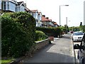
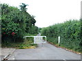
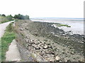
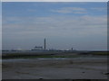
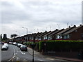
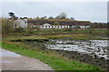
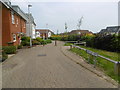
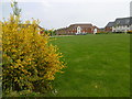
73 photos from this area
Area Information
Key information about the ME7 2TY including its size, population, and administrative classification.
- Area Type
- Postcode
- Area Size
- 2.5 hectares
- Population
- 2541
- Population Density
- 3544 people/km²
House Prices in ME7 2TY
10
Properties
£279,250
Average Sold Price
£195,000
Lowest Price
£355,000
Highest Price
Showing 10 properties
| Address | Type | Beds | Baths | Last Sale Price | Last Sale Date | |
|---|---|---|---|---|---|---|
| 61 Danes Hill, Gillingham, ME7 2TY | Detached | 2 | 1 | £260,000 | Aug 2025 | |
| 62 Danes Hill, Gillingham, ME7 2TY | house | - | - | £315,000 | Apr 2021 | |
| 59A Danes Hill, Gillingham, ME7 2TY | Chalet | 4 | 2 | £355,000 | Jan 2021 | |
| 56 Danes Hill, Gillingham, ME7 2TY | Detached | 4 | 2 | £311,000 | Jul 2018 | |
| 59 Danes Hill, Gillingham, ME7 2TY | Bungalow | 3 | - | £239,500 | Feb 2014 | |
| 58 Danes Hill, Gillingham, ME7 2TY | Terraced | - | - | £195,000 | May 2012 | |
| 54 Danes Hill, Gillingham, ME7 2TY | Semi-detached | 3 | 1 | - | - | |
| 55 Danes Hill, Gillingham, ME7 2TY | Semi-detached | - | - | - | - | |
| 63 Danes Hill, Gillingham, ME7 2TY | Bungalow | - | - | - | - | |
| Flat, Plough And Chequers, Danes Hill, Gillingham, ME7 2TY | Flat | - | - | - | - |
Energy Efficiency in ME7 2TY
Amenities
Schools
| Rank | School | Type | Entry gender | Ages |
|---|
Explore more schools in this area
Go to Schools tabDemographics
Household Size
Family (3-5 people)
most common
Accommodation Type
Houses
most common
Tenure
70
majority
Ethnic Group
White
most common
Religion
N/A
most common
Household Composition
N/A
most common
Age
47
median
Adults (30-64 years)
most common
Household Deprivation
N/A
with no deprivation
NS-SEC
32
in Lower managerial occupations
Explore more demographic insights in this area
Go to Demographics tabPlanning
Planning Constraints
- Flood RiskPremium
- Ramsar Wetland SitesPremium
- Area of Outstanding Natural BeautyPremium
- Protected Nature ReservePremium
- Protected WoodlandPremium