Area Overview for ME7 2DT
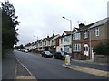
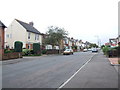
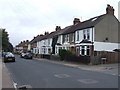
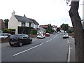
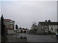
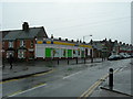
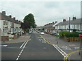
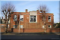
Photos of ME7 2DT


Area Information
Living in ME7 2DT offers a quiet, residential experience in a small cluster of homes. With a population of 1510, the area is compact but well-served by nearby amenities. The community is predominantly composed of adults aged 30–64, creating a stable, family-oriented environment. Daily life here is defined by proximity to local shops, schools, and transport links. The area’s housing stock is largely made up of owner-occupied homes, reflecting a settled demographic. While the postcode covers a small footprint, its location provides access to broader services in Gillingham and surrounding towns. Residents benefit from strong broadband connectivity and a network of railway stations, making commuting or travel straightforward. The area’s character is shaped by its mix of practical living and accessible infrastructure, ideal for those seeking a balanced lifestyle without the pressures of larger urban centres.
- Area Type
- Postcode
- Area Size
- Not available
- Population
- 1510
- Population Density
- 2138 people/km²
The property market in ME7 2DT is characterised by a mix of owner-occupied and rental homes, with 44% of properties owned by residents. The area’s housing stock is predominantly houses, which suggests a focus on family homes and single-family living. Given the small size of the postcode, the market is likely limited in scale, with properties concentrated in a compact cluster. Buyers should consider the proximity to nearby towns like Gillingham, where additional housing options may be available. The owner-occupation rate indicates a community of long-term residents, which can influence property values and demand. For those seeking a home in ME7 2DT, the emphasis on houses may appeal to buyers prioritising space and privacy, though the limited size of the area means competition for available properties could be keen.
House Prices in ME7 2DT
No properties found in this postcode.
Energy Efficiency in ME7 2DT
The lifestyle in ME7 2DT is supported by a range of nearby amenities. Local shopping is convenient, with major retailers like Tesco Gillingham, Asda Gillingham, and Sainsburys Gillingham within reach. The area’s rail network connects residents to Gillingham, Chatham, and Rainham stations, facilitating easy access to larger towns and services. Rochester Airport provides additional travel options for those requiring regional or international flights. These amenities contribute to a practical, accessible lifestyle, with opportunities for shopping, commuting, and travel without the need for long journeys. The presence of these facilities ensures daily life remains efficient and connected, supporting both personal and professional needs.
Amenities
Schools
Residents of ME7 2DT have access to a range of educational institutions, including Woodlands Primary School and The Academy of Woodlands, which cater to primary and secondary education. The Gillingham Community College and Will Adams Centre provide additional learning opportunities, while Will Adams Academy offers further education services. The diversity of school types ensures families can choose between traditional state schools and academies. This mix supports both local and broader educational needs, making the area suitable for households with children of varying ages. The presence of multiple schools within reach enhances the area’s appeal for families seeking reliable, accessible education options.
| Rank | School | Type | Entry gender | Ages |
|---|
Explore more schools in this area
Go to Schools tabDemographics
ME7 2DT has a median age of 47, with the majority of residents falling in the 30–64 age range. This suggests a community of established professionals and families, rather than students or retirees. Home ownership stands at 44%, indicating a mix of owner-occupied properties and rental homes. The area is predominantly composed of houses, reflecting a more traditional housing stock compared to high-density developments. The predominant ethnic group is White, though specific data on diversity is not provided. The age profile and ownership figures point to a mature, stable population with long-term residency patterns. This demographic structure supports a community with shared interests in local amenities and services, fostering a cohesive neighbourhood dynamic.
Household Size
Accommodation Type
Tenure
Ethnic Group
Religion
Household Composition
Age
Household Deprivation
NS-SEC
Explore more demographic insights in this area
Go to Demographics tabPlanning
Planning Constraints
- Flood RiskPremium
- Ramsar Wetland SitesPremium
- Area of Outstanding Natural BeautyPremium
- Protected Nature ReservePremium
- Protected WoodlandPremium