Area Overview for ME7 1TG
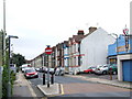
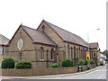
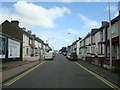
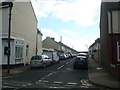
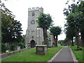
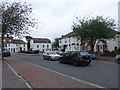
Photos of ME7 1TG


Area Information
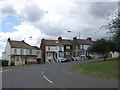
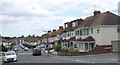
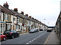
ME7 1TG is a small, tightly knit residential postcode area in England, home to around 1,610 people. It is a compact cluster of homes, primarily occupied by adults aged 30 to 64, with a median age of 47. The area’s size means it is not a sprawling suburb but a focused community where daily life is shaped by proximity to local amenities. Residents benefit from easy access to nearby retail hubs, rail networks, and Rochester Airport, making it a practical choice for commuters and those who value convenience. The area’s appeal lies in its balance of residential tranquillity and practical connectivity, though its small size means it is best suited for those prioritising proximity to services over expansive green spaces. With 60% of homes owner-occupied, the community feels stable, and the predominantly White demographic reflects a long-standing local presence. For buyers, ME7 1TG offers a snapshot of English suburban living, where familiarity with the surroundings and ease of access to transport and shopping are key advantages.
- Area Type
- Postcode
- Area Size
- Not available
- Population
- 1610
- Population Density
- 7502 people/km²
ME7 1TG is primarily an owner-occupied area, with 60% of homes owned by residents rather than rented. The accommodation type is predominantly houses, which suggests a focus on single-family living rather than apartments or shared housing. This makes the area appealing to buyers seeking traditional homes, particularly those with families or professionals looking for space. The small size of the postcode means the housing stock is limited, and the immediate surroundings may offer additional options. For buyers, this could mean competition for properties, but the high home ownership rate also indicates a stable market with long-term residents. The absence of flats or larger developments suggests a uniformity in housing types, which may limit variety but ensure a consistent character across the area.
House Prices in ME7 1TG
No properties found in this postcode.
Energy Efficiency in ME7 1TG
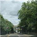
Living in ME7 1TG offers access to a range of essential amenities within easy reach. The area is served by five retail outlets, including Tesco Victory, Sainsburys Gillingham, and Lidl GIL, providing convenient shopping options for groceries and everyday needs. Nearby rail stations such as Gillingham, Chatham, and Rochester offer regular services, connecting residents to broader regional networks. Rochester Airport is also within reach, adding to the area’s appeal for those requiring frequent travel. While the data does not specify parks or leisure facilities, the proximity to rail and retail suggests a lifestyle focused on practicality and accessibility. The availability of multiple retail and transport options ensures that daily routines are efficient, supporting both work and personal needs.
Amenities
Schools
| Rank | School | Type | Entry gender | Ages |
|---|
Explore more schools in this area
Go to Schools tabDemographics
The population of ME7 1TG is predominantly adults, with 30-64-year-olds making up the most common age range. The median age of 47 suggests a mature community, likely with established families and professionals. Home ownership is high at 60%, indicating a strong local presence of long-term residents rather than transient renters. The area is characterised by houses rather than flats, reflecting a preference for single-family homes. The predominant ethnic group is White, though no specific data on other ethnicities is available. This demographic profile implies a community with a focus on stability and continuity, where local schools and amenities are likely to cater to the needs of middle-aged residents and their families. The absence of detailed diversity data means the area’s social composition remains largely defined by its core demographic.
Household Size
Accommodation Type
Tenure
Ethnic Group
Religion
Household Composition
Age
Household Deprivation
NS-SEC
Explore more demographic insights in this area
Go to Demographics tabPlanning
Planning Constraints
- Flood RiskPremium
- Ramsar Wetland SitesPremium
- Area of Outstanding Natural BeautyPremium
- Protected Nature ReservePremium
- Protected WoodlandPremium