Area Overview for ME7 1HW
Photos of ME7 1HW
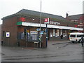

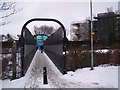
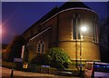
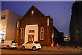
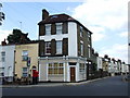
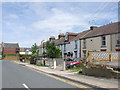
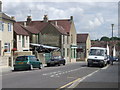
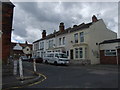
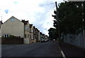
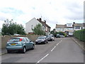
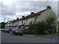
100 photos from this area
Area Information
Key information about the ME7 1HW including its size, population, and administrative classification.
- Area Type
- Postcode
- Area Size
- 2660 m²
- Population
- 1961
- Population Density
- 6014 people/km²
House Prices in ME7 1HW
33
Properties
£190,769
Average Sold Price
£45,000
Lowest Price
£410,000
Highest Price
Showing 33 properties
| Address | Type | Beds | Baths | Last Sale Price | Last Sale Date | |
|---|---|---|---|---|---|---|
| 53 Mill Road, Gillingham, ME7 1HW | Terraced | 2 | 1 | £173,000 | Jun 2023 | |
| 60 Mill Road, Gillingham, ME7 1HW | Terraced | 1 | 5 | £410,000 | Aug 2022 | |
| 59 Mill Road, Gillingham, ME7 1HW | Retail | 4 | 1 | £355,000 | Aug 2022 | |
| 57 Mill Road, Gillingham, ME7 1HW | Maisonette | 2 | 1 | £170,000 | Nov 2021 | |
| 46A Mill Road, Gillingham, ME7 1HW | Terraced | 6 | 4 | £315,000 | Aug 2021 | |
| 52 Mill Road, Gillingham, ME7 1HW | Terraced | 3 | 1 | £197,500 | Feb 2020 | |
| 54 Mill Road, Gillingham, ME7 1HW | Terraced | 3 | 1 | £191,000 | Mar 2017 | |
| 56 Mill Road, Gillingham, ME7 1HW | Terraced | 3 | 1 | £198,000 | Sep 2015 | |
| 55 Mill Road, Gillingham, ME7 1HW | Terraced | 4 | 1 | £145,000 | Jun 2011 | |
| 48 Mill Road, Gillingham, ME7 1HW | Flat | 1 | - | £90,000 | Jan 2006 |
Page 1 of 4
Energy Efficiency in ME7 1HW
Amenities
Schools
| Rank | School | Type | Entry gender | Ages |
|---|
Explore more schools in this area
Go to Schools tabDemographics
Household Size
Family (3-5 people)
most common
Accommodation Type
Houses
most common
Tenure
36
majority
Ethnic Group
White
most common
Religion
N/A
most common
Household Composition
N/A
most common
Age
47
median
Adults (30-64 years)
most common
Household Deprivation
N/A
with no deprivation
NS-SEC
22
in Lower managerial occupations
Explore more demographic insights in this area
Go to Demographics tabPlanning
Planning Constraints
- Flood RiskPremium
- Ramsar Wetland SitesPremium
- Area of Outstanding Natural BeautyPremium
- Protected Nature ReservePremium
- Protected WoodlandPremium