Area Overview for ME5 8UJ
Photos of ME5 8UJ
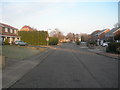
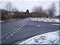
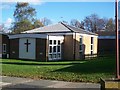
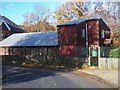
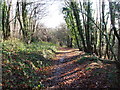
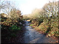
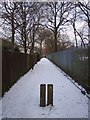
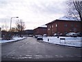
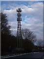
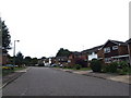
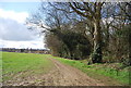
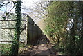
80 photos from this area
Area Information
Key information about the ME5 8UJ including its size, population, and administrative classification.
- Area Type
- Postcode
- Area Size
- 5814 m²
- Population
- 1464
- Population Density
- 4970 people/km²
House Prices in ME5 8UJ
26
Properties
£191,529
Average Sold Price
£74,000
Lowest Price
£335,000
Highest Price
Showing 26 properties
| Address | Type | Beds | Baths | Last Sale Price | Last Sale Date | |
|---|---|---|---|---|---|---|
| 34 Rudge Close, Lordswood, Chatham, ME5 8UJ | Terraced | 2 | 1 | £285,000 | Oct 2024 | |
| 19 Rudge Close, Lordswood, Chatham, ME5 8UJ | Terraced | 3 | 1 | £310,000 | May 2023 | |
| 11 Rudge Close, Lordswood, Chatham, ME5 8UJ | Retail | 3 | 1 | £335,000 | Nov 2022 | |
| 16 Rudge Close, Lordswood, Chatham, ME5 8UJ | Maisonette | 1 | 1 | £172,000 | Aug 2022 | |
| 10 Rudge Close, Lordswood, Chatham, ME5 8UJ | Flat | 1 | 1 | £163,000 | Jan 2022 | |
| 9 Rudge Close, Lordswood, Chatham, ME5 8UJ | house | - | - | £305,000 | Nov 2021 | |
| 14 Rudge Close, Lordswood, Chatham, ME5 8UJ | Maisonette | 1 | 1 | £162,000 | Mar 2021 | |
| 28 Rudge Close, Lordswood, Chatham, ME5 8UJ | house | 2 | - | £230,000 | Jan 2021 | |
| 30 Rudge Close, Lordswood, Chatham, ME5 8UJ | Terraced | 2 | 1 | £204,000 | Feb 2019 | |
| 26 Rudge Close, Lordswood, Chatham, ME5 8UJ | Terraced | 2 | 1 | £240,000 | Nov 2018 |
Page 1 of 3
Energy Efficiency in ME5 8UJ
Amenities
Schools
| Rank | School | Type | Entry gender | Ages |
|---|
Explore more schools in this area
Go to Schools tabDemographics
Household Size
Family (3-5 people)
most common
Accommodation Type
Houses
most common
Tenure
66
majority
Ethnic Group
White
most common
Religion
N/A
most common
Household Composition
N/A
most common
Age
47
median
Adults (30-64 years)
most common
Household Deprivation
N/A
with no deprivation
NS-SEC
29
in Lower managerial occupations
Explore more demographic insights in this area
Go to Demographics tabPlanning
Planning Constraints
- Flood RiskPremium
- Ramsar Wetland SitesPremium
- Area of Outstanding Natural BeautyPremium
- Protected Nature ReservePremium
- Protected WoodlandPremium