Area Overview for ME5 7HG
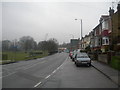
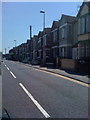
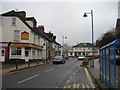
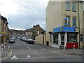
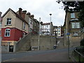
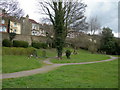
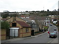
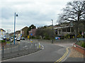
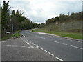
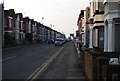
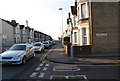
Photos of ME5 7HG

Area Information
ME5 7HG is a small, tightly knit residential postcode area in England, home to around 1,486 people. Its compact size means it offers a quiet, community-focused lifestyle, with easy access to nearby towns and amenities. The area’s character is defined by its mix of older and newer housing stock, predominantly family homes that cater to a population skewed toward adults aged 30–64. Residents benefit from proximity to key services, including multiple retail outlets and rail connections. While the area lacks large-scale commercial hubs, its small footprint ensures a sense of familiarity and convenience. The low flood risk and absence of protected natural sites suggest a practical, low-maintenance environment. However, the high crime risk—above the national average—requires attention to security. For those seeking a place with a balance of accessibility and tranquillity, ME5 7HG provides a distinct blend of local charm and functional living.
- Area Type
- Postcode
- Area Size
- Not available
- Population
- 1486
- Population Density
- 6152 people/km²
ME5 7HG is primarily an owner-occupied area, with 72% of residents living in their own homes. The accommodation type is predominantly houses, which are more common than flats or apartments in this postcode. This suggests a housing stock tailored to families or individuals seeking larger living spaces. Given the small size of the area, the property market is likely limited to a few dozen homes, making it a niche market for buyers. The high home ownership rate indicates strong local attachment, though it may also mean fewer rental options for those seeking temporary housing. For buyers, the focus on houses implies a need for space, but the area’s compact nature means proximity to amenities is a key advantage.
House Prices in ME5 7HG
No properties found in this postcode.
Energy Efficiency in ME5 7HG
Living in ME5 7HG offers a blend of convenience and local character. Within walking distance are retail options such as Co-op Canterbury, Morrisons Daily, and Tesco Gillingham, ensuring everyday needs are met without long journeys. The proximity to rail stations like Gillingham and Rochester provides easy access to regional transport networks, whether for commuting or leisure. The nearby Rochester Airport adds to the area’s connectivity, though it is not a major hub. While the area lacks large parks or entertainment venues, the presence of multiple retail outlets and rail links suggests a practical, service-oriented lifestyle. The compact nature of the postcode means residents can access essential amenities without venturing far, fostering a self-contained community feel.
Amenities
Schools
| Rank | School | Type | Entry gender | Ages |
|---|
Explore more schools in this area
Go to Schools tabDemographics
The population of ME5 7HG is predominantly adults aged 30–64, with a median age of 47. This suggests a community of established professionals and families, rather than students or retirees. Home ownership is high at 72%, indicating a stable, long-term resident base. The area is largely composed of houses, not flats, which aligns with the demographic profile of older, family-oriented households. The predominant ethnic group is White, reflecting the broader regional trends. The absence of specific deprivation data means the quality of life is not explicitly tied to economic hardship, though the high home ownership rate implies financial stability for many residents. The age range and housing type suggest a focus on comfort and space, with fewer rental properties or transient populations.
Household Size
Accommodation Type
Tenure
Ethnic Group
Religion
Household Composition
Age
Household Deprivation
NS-SEC
Explore more demographic insights in this area
Go to Demographics tabPlanning
Planning Constraints
- Flood RiskPremium
- Ramsar Wetland SitesPremium
- Area of Outstanding Natural BeautyPremium
- Protected Nature ReservePremium
- Protected WoodlandPremium