Area Overview for ME5 7BQ
Photos of ME5 7BQ
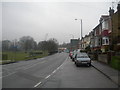
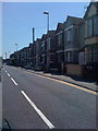
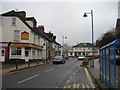
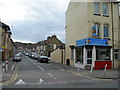
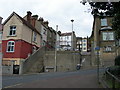
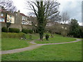
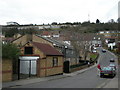
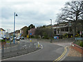
100 photos from this area
Area Information
Key information about the ME5 7BQ including its size, population, and administrative classification.
- Area Type
- Postcode
- Area Size
- 8421 m²
- Population
- 1695
- Population Density
- 10095 people/km²
House Prices in ME5 7BQ
62
Properties
£126,369
Average Sold Price
£25,000
Lowest Price
£250,000
Highest Price
Showing 62 properties
| Address | Type | Beds | Baths | Last Sale Price | Last Sale Date | |
|---|---|---|---|---|---|---|
| 70 Upper Luton Road, Luton, Chatham, ME5 7BQ | Flat | - | - | £165,000 | Mar 2023 | |
| 178 Upper Luton Road, Luton, Chatham, ME5 7BQ | Terraced | 2 | 1 | £202,500 | Apr 2022 | |
| 96 Upper Luton Road, Luton, Chatham, ME5 7BQ | Flat | 2 | 1 | £95,000 | Mar 2022 | |
| 194 Upper Luton Road, Luton, Chatham, ME5 7BQ | Terraced | 3 | 1 | £250,000 | Sep 2021 | |
| 196 Upper Luton Road, Luton, Chatham, ME5 7BQ | house | - | - | £225,000 | Jun 2021 | |
| 186 Upper Luton Road, Luton, Chatham, ME5 7BQ | house | - | - | £170,000 | May 2021 | |
| 190 Upper Luton Road, Luton, Chatham, ME5 7BQ | house | - | - | £180,000 | Dec 2020 | |
| 136 Upper Luton Road, Luton, Chatham, ME5 7BQ | house | - | - | £135,000 | Nov 2020 | |
| 90 Upper Luton Road, Luton, Chatham, ME5 7BQ | Maisonette | 2 | 1 | £123,000 | Aug 2020 | |
| 142 Upper Luton Road, Luton, Chatham, ME5 7BQ | Terraced | 3 | 1 | £147,500 | Jun 2020 |
Page 1 of 7
Energy Efficiency in ME5 7BQ
Amenities
Schools
| Rank | School | Type | Entry gender | Ages |
|---|
Explore more schools in this area
Go to Schools tabDemographics
Household Size
Family (3-5 people)
most common
Accommodation Type
Houses
most common
Tenure
50
majority
Ethnic Group
White
most common
Religion
N/A
most common
Household Composition
N/A
most common
Age
47
median
Adults (30-64 years)
most common
Household Deprivation
N/A
with no deprivation
NS-SEC
20
in Lower managerial occupations
Explore more demographic insights in this area
Go to Demographics tabPlanning
Planning Constraints
- Flood RiskPremium
- Ramsar Wetland SitesPremium
- Area of Outstanding Natural BeautyPremium
- Protected Nature ReservePremium
- Protected WoodlandPremium