Area Overview for ME4 4ET
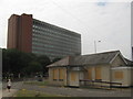
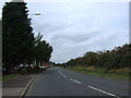
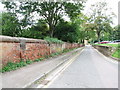
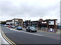
Photos of ME4 4ET


Area Information
Living in ME4 4ET means inhabiting a tightly packed residential cluster in England, where 1,497 people reside across just 1.1 hectares. This density creates a compact, closely knit community, though the area’s small size means amenities and services are within practical reach. The postcode is bordered by practical transport links, including multiple rail stations and a nearby airport, which connect residents to broader networks. Daily life here is shaped by its proximity to Fort Pitt Grammar School, a dual-purpose primary and academy with an outstanding Ofsted rating, making it a key draw for families. The area’s demographics suggest a mature population, with adults aged 30–64 forming the majority. While the housing stock is predominantly flats, the 25% home ownership rate indicates a rental-heavy market. For those considering ME4 4ET, the blend of accessibility, education, and limited space offers a distinct, if tightly contained, lifestyle.
- Area Type
- Postcode
- Area Size
- 1.1 hectares
- Population
- 1497
- Population Density
- 2147 people/km²
The property market in ME4 4ET is defined by its small size and high density. With 25% of residents owning their homes, the area is predominantly a rental market, likely influenced by its compact nature and limited housing stock. Flats are the primary accommodation type, which suits the confined space but may appeal more to renters than buyers seeking larger properties. The small area size means housing options are limited, and buyers may need to look beyond ME4 4ET’s immediate boundaries for more variety. For those considering purchase, the high population density and focus on flats suggest competition for available properties. The rental market’s dominance could also mean fluctuating demand, particularly for short-term lets. Given the area’s size, property values may be influenced more by proximity to amenities like schools and transport links than by the intrinsic characteristics of the housing stock itself.
House Prices in ME4 4ET
No properties found in this postcode.
Energy Efficiency in ME4 4ET
The lifestyle in ME4 4ET is shaped by its proximity to essential amenities. Retail options include Sainsburys Chatham, Iceland Chatham, and Co-op Delce, providing access to grocery and daily necessities. The five rail stations nearby—Chatham, Rochester, and Strood—offer convenient travel links, while Rochester Airport provides a gateway for regional and national flights. Though the area is small, the concentration of retail, transport, and air travel options ensures residents have practical access to services without needing to travel far. The presence of Fort Pitt Grammar School also adds to the area’s appeal, combining educational needs with everyday convenience. The compact nature of ME4 4ET means amenities are tightly clustered, fostering a self-contained environment where daily life is manageable within short distances.
Amenities
Schools
The schools near ME4 4ET include Fort Pitt Grammar School, which serves both as a primary school and an academy with an outstanding Ofsted rating. This dual role provides a seamless educational pathway for families, covering early years through to secondary education. The outstanding rating indicates high standards in teaching, facilities, and student outcomes, which is a significant draw for parents prioritising quality education. However, the absence of other schools in the data means the area relies heavily on Fort Pitt Grammar School for its educational needs. For families, this concentration of resources could be both a benefit and a limitation, depending on the school’s capacity to accommodate all local students. The presence of a top-rated institution enhances the area’s appeal but may also contribute to demand for housing in its vicinity.
| Rank | School | Type | Entry gender | Ages |
|---|
Explore more schools in this area
Go to Schools tabDemographics
ME4 4ET’s population of 1,497 is dominated by adults aged 30–64, with a median age of 47. This suggests a community of established professionals and families, rather than younger or elderly residents. Home ownership is low, with only 25% of residents owning their homes, implying a strong rental market. The accommodation type is primarily flats, reflecting the area’s compact footprint. The predominant ethnic group is White, though no further diversity data is provided. The high population density of 140,592 people per square kilometre indicates a tightly packed environment, which may influence the character of daily life. While this density can foster community interaction, it also means limited space for expansion or new developments. The demographic profile suggests a stable, mature population with established needs, though the lack of data on deprivation or income levels means quality-of-life factors beyond ownership and age remain unexplored.
Household Size
Accommodation Type
Tenure
Ethnic Group
Religion
Household Composition
Age
Household Deprivation
NS-SEC
Explore more demographic insights in this area
Go to Demographics tabPlanning
Planning Constraints
- Flood RiskPremium
- Ramsar Wetland SitesPremium
- Area of Outstanding Natural BeautyPremium
- Protected Nature ReservePremium
- Protected WoodlandPremium