Area Overview for ME3 8FS
Photos of ME3 8FS
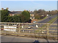


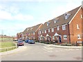
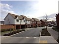
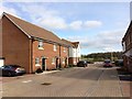
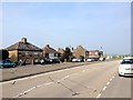
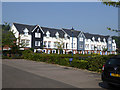
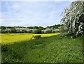
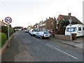
45 photos from this area
Area Information
Key information about the ME3 8FS including its size, population, and administrative classification.
- Area Type
- Postcode
- Area Size
- 5.0 hectares
- Population
- 1528
- Population Density
- 1152 people/km²
House Prices in ME3 8FS
45
Properties
£242,677
Average Sold Price
£131,250
Lowest Price
£432,000
Highest Price
Showing 45 properties
| Address | Type | Beds | Baths | Last Sale Price | Last Sale Date | |
|---|---|---|---|---|---|---|
| 24 Spire Way, Wainscott, Rochester, ME3 8FS | Detached | 2 | 1 | £245,000 | Mar 2023 | |
| 82 Spire Way, Wainscott, Rochester, ME3 8FS | house | - | - | £131,250 | Jan 2023 | |
| 16 Spire Way, Wainscott, Rochester, ME3 8FS | Terraced | 4 | 2 | £432,000 | Dec 2022 | |
| 60 Spire Way, Wainscott, Rochester, ME3 8FS | Retail | 2 | 1 | £276,200 | Aug 2022 | |
| 4 Spire Way, Wainscott, Rochester, ME3 8FS | Terraced | 3 | 2 | £355,000 | May 2021 | |
| 18 Spire Way, Wainscott, Rochester, ME3 8FS | Semi-detached | 3 | 1 | £310,000 | Mar 2020 | |
| 54 Spire Way, Wainscott, Rochester, ME3 8FS | Terraced | 3 | 2 | £285,000 | Feb 2020 | |
| 46 Spire Way, Wainscott, Rochester, ME3 8FS | Terraced | 3 | 1 | £280,000 | Jan 2020 | |
| 48 Spire Way, Wainscott, Rochester, ME3 8FS | Terraced | 3 | 3 | £288,000 | Jul 2019 | |
| 12 Spire Way, Wainscott, Rochester, ME3 8FS | Terraced | 4 | 1 | £302,000 | Oct 2018 |
Page 1 of 5
Energy Efficiency in ME3 8FS
Amenities
Schools
| Rank | School | Type | Entry gender | Ages |
|---|
Explore more schools in this area
Go to Schools tabDemographics
Household Size
Family (3-5 people)
most common
Accommodation Type
Houses
most common
Tenure
58
majority
Ethnic Group
White
most common
Religion
N/A
most common
Household Composition
N/A
most common
Age
47
median
Adults (30-64 years)
most common
Household Deprivation
N/A
with no deprivation
NS-SEC
28
in Lower managerial occupations
Explore more demographic insights in this area
Go to Demographics tabPlanning
Planning Constraints
- Flood RiskPremium
- Ramsar Wetland SitesPremium
- Area of Outstanding Natural BeautyPremium
- Protected Nature ReservePremium
- Protected WoodlandPremium