Area Overview for ME3 7QS
Photos of ME3 7QS
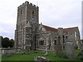
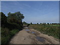
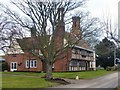
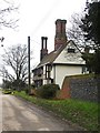
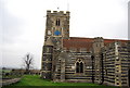
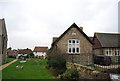
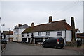
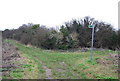
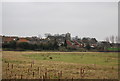
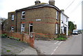

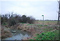
100 photos from this area
Area Information
Key information about the ME3 7QS including its size, population, and administrative classification.
- Area Type
- Postcode
- Area Size
- 27.7 hectares
- Population
- 1527
- Population Density
- 193 people/km²
House Prices in ME3 7QS
24
Properties
£391,667
Average Sold Price
£250,000
Lowest Price
£715,000
Highest Price
Showing 24 properties
| Address | Type | Beds | Baths | Last Sale Price | Last Sale Date | |
|---|---|---|---|---|---|---|
| The Apple Loft, Pond Hill, Cliffe, Rochester, ME3 7QS | Semi-detached | 4 | 2 | £715,000 | Feb 2024 | |
| 14, Courtsole Farm, Pond Hill, Cliffe, Rochester, ME3 7QS | Terraced | 3 | 2 | £375,000 | Jun 2021 | |
| 11, Courtsole Farm, Pond Hill, Cliffe, Rochester, ME3 7QS | Bungalow | 2 | - | £390,000 | Feb 2021 | |
| 6, Courtsole Farm, Pond Hill, Cliffe, Rochester, ME3 7QS | Terraced | 3 | 2 | £360,000 | Jun 2017 | |
| Blackmoore Barn, Pond Hill, Cliffe, Rochester, ME3 7QS | Semi-detached | 4 | - | £675,000 | May 2015 | |
| 7, Courtsole Farm, Pond Hill, Cliffe, Rochester, ME3 7QS | house | - | - | £460,000 | Dec 2014 | |
| 12, Courtsole Farm, Pond Hill, Cliffe, Rochester, ME3 7QS | Terraced | 3 | 2 | £270,000 | Oct 2014 | |
| 13, Courtsole Farm, Pond Hill, Cliffe, Rochester, ME3 7QS | house | 3 | - | £250,000 | Oct 2014 | |
| 10, Courtsole Farm, Pond Hill, Cliffe, Rochester, ME3 7QS | Detached | 3 | 3 | £340,000 | Sep 2014 | |
| 8, Courtsole Farm, Pond Hill, Cliffe, Rochester, ME3 7QS | Bungalow | 4 | - | £350,000 | Sep 2014 |
Page 1 of 3
Energy Efficiency in ME3 7QS
Amenities
Schools
| Rank | School | Type | Entry gender | Ages |
|---|
Explore more schools in this area
Go to Schools tabDemographics
Household Size
Family (3-5 people)
most common
Accommodation Type
Houses
most common
Tenure
70
majority
Ethnic Group
White
most common
Religion
N/A
most common
Household Composition
N/A
most common
Age
47
median
Adults (30-64 years)
most common
Household Deprivation
N/A
with no deprivation
NS-SEC
25
in Lower managerial occupations
Explore more demographic insights in this area
Go to Demographics tabPlanning
Planning Constraints
- Flood RiskPremium
- Ramsar Wetland SitesPremium
- Area of Outstanding Natural BeautyPremium
- Protected Nature ReservePremium
- Protected WoodlandPremium