Area Overview for ME20 7HT
Photos of ME20 7HT
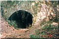
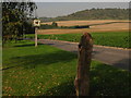
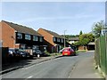
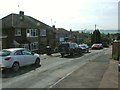
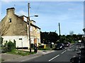
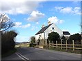
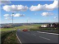

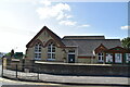
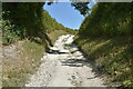
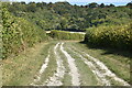
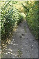
46 photos from this area
Area Information
Key information about the ME20 7HT including its size, population, and administrative classification.
- Area Type
- Postcode
- Area Size
- 12.2 hectares
- Population
- 1757
- Population Density
- 547 people/km²
House Prices in ME20 7HT
24
Properties
£295,611
Average Sold Price
£58,500
Lowest Price
£585,000
Highest Price
Showing 24 properties
| Address | Type | Beds | Baths | Last Sale Price | Last Sale Date | |
|---|---|---|---|---|---|---|
| 128 Bull Lane, Eccles, Aylesford, ME20 7HT | Semi-detached | 3 | 1 | £350,000 | Nov 2025 | |
| 117 Bull Lane, Eccles, Aylesford, ME20 7HT | Detached | 4 | 2 | £585,000 | Sep 2025 | |
| 135 Bull Lane, Eccles, Aylesford, ME20 7HT | Semi-detached | 4 | 3 | £450,000 | Mar 2022 | |
| 136 Bull Lane, Eccles, Aylesford, ME20 7HT | house | - | - | £240,000 | Aug 2021 | |
| 105 Bull Lane, Eccles, Aylesford, ME20 7HT | Semi-detached | 3 | 1 | £290,000 | Jul 2019 | |
| 137 Bull Lane, Eccles, Aylesford, ME20 7HT | Semi-detached | 4 | 2 | £421,000 | Jul 2015 | |
| 143 Bull Lane, Eccles, Aylesford, ME20 7HT | Bungalow | 4 | 3 | £205,000 | Dec 2007 | |
| 145 Bull Lane, Eccles, Aylesford, ME20 7HT | Bungalow | - | - | £58,500 | Dec 1996 | |
| 141 Bull Lane, Eccles, Aylesford, ME20 7HT | Semi-detached | - | - | £61,000 | Oct 1995 | |
| Pear Tree Cottage, 111 Bull Lane, Eccles, Aylesford, ME20 7HT | Detached | - | - | - | - |
Page 1 of 3
Energy Efficiency in ME20 7HT
Amenities
Schools
| Rank | School | Type | Entry gender | Ages |
|---|
Explore more schools in this area
Go to Schools tabDemographics
Household Size
Two person
most common
Accommodation Type
Houses
most common
Tenure
71
majority
Ethnic Group
White
most common
Religion
N/A
most common
Household Composition
N/A
most common
Age
47
median
Adults (30-64 years)
most common
Household Deprivation
N/A
with no deprivation
NS-SEC
32
in Lower managerial occupations
Explore more demographic insights in this area
Go to Demographics tabPlanning
Planning Constraints
- Flood RiskPremium
- Ramsar Wetland SitesPremium
- Protected Nature ReservePremium
- Protected WoodlandPremium