Area Overview for ME20 7BA
Photos of ME20 7BA
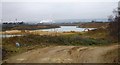
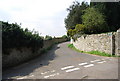
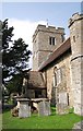
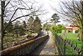
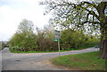
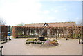
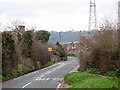

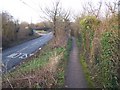
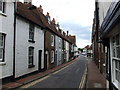
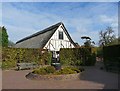
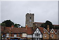
70 photos from this area
Area Information
Key information about the ME20 7BA including its size, population, and administrative classification.
- Area Type
- Postcode
- Area Size
- 9300 m²
- Population
- 2280
- Population Density
- 437 people/km²
House Prices in ME20 7BA
24
Properties
£239,766
Average Sold Price
£80,000
Lowest Price
£499,995
Highest Price
Showing 24 properties
| Address | Type | Beds | Baths | Last Sale Price | Last Sale Date | |
|---|---|---|---|---|---|---|
| 70 High Street, Aylesford, ME20 7BA | Terraced | 2 | 1 | £215,000 | Apr 2023 | |
| 74 High Street, Aylesford, ME20 7BA | Terraced | - | - | £275,000 | Sep 2022 | |
| 54 High Street, Aylesford, ME20 7BA | Terraced | 3 | 1 | £258,500 | Aug 2022 | |
| 26 High Street, Aylesford, ME20 7BA | house | 4 | 2 | £499,995 | May 2021 | |
| 40 High Street, Aylesford, ME20 7BA | Terraced | 3 | 1 | £280,000 | Mar 2021 | |
| 64 High Street, Aylesford, ME20 7BA | Terraced | 2 | 1 | £216,000 | Jul 2019 | |
| 36 High Street, Aylesford, ME20 7BA | Terraced | 2 | 1 | £230,000 | Apr 2019 | |
| 24 High Street, Aylesford, ME20 7BA | Semi-detached | - | - | £475,000 | Jul 2017 | |
| 78 High Street, Aylesford, ME20 7BA | house | - | - | £165,000 | Jun 2009 | |
| 66 High Street, Aylesford, ME20 7BA | Terraced | - | - | £175,000 | Jan 2009 |
Page 1 of 3
Energy Efficiency in ME20 7BA
Amenities
Schools
| Rank | School | Type | Entry gender | Ages |
|---|
Explore more schools in this area
Go to Schools tabDemographics
Household Size
Family (3-5 people)
most common
Accommodation Type
Houses
most common
Tenure
74
majority
Ethnic Group
White
most common
Religion
N/A
most common
Household Composition
N/A
most common
Age
47
median
Adults (30-64 years)
most common
Household Deprivation
N/A
with no deprivation
NS-SEC
39
in Lower managerial occupations
Explore more demographic insights in this area
Go to Demographics tabPlanning
Planning Constraints
- Flood RiskPremium
- Ramsar Wetland SitesPremium
- Area of Outstanding Natural BeautyPremium
- Protected Nature ReservePremium
- Protected WoodlandPremium