Area Overview for ME20 7AE
Photos of ME20 7AE
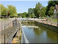

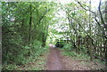
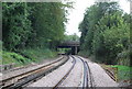
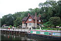
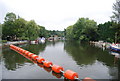


100 photos from this area
Area Information
Key information about the ME20 7AE including its size, population, and administrative classification.
- Area Type
- Postcode
- Area Size
- 8.4 hectares
- Population
- 1695
- Population Density
- 85 people/km²
House Prices in ME20 7AE
10
Properties
£229,500
Average Sold Price
£69,000
Lowest Price
£390,000
Highest Price
Showing 10 properties
| Address | Type | Beds | Baths | Last Sale Price | Last Sale Date | |
|---|---|---|---|---|---|---|
| Forstal House, Forstal Road, Sandling, Aylesford, ME20 7AE | Detached | 3 | - | £390,000 | Jul 2021 | |
| Grapecroft, Forstal Road, Sandling, Aylesford, ME20 7AE | Semi-detached | - | - | £69,000 | Oct 1995 | |
| 1A, Vineholme, Forstal Road, Sandling, Aylesford, ME20 7AE | Flat | - | - | - | - | |
| 1B, Vineholme, Forstal Road, Sandling, Aylesford, ME20 7AE | Flat | - | - | - | - | |
| Minster, Minster Insultation And Dry Lining, Forstal Road, Sandling, Aylesford, ME20 7AE | general_industrial | - | - | - | - | |
| Cobtree Cafe Ltd, Cobtree Cabin, Cobtree Manor Park, Forstal Road, Sandling, Aylesford, ME20 7AE | Restaurant | - | - | - | - | |
| Cobtree Cafe And Visitor Centre, Cobtree Manor Park, Forstal Road, Sandling, Aylesford, ME20 7AE | restaurant_cafe | - | - | - | - | |
| The Sir Garrard Tyrwhitt Drake Visitor Centre, Cobtree Manor Park, Forstal Road, Sandling, Aylesford, ME20 7AE | shop | - | - | - | - | |
| Vineholme, Forstal Road, Sandling, Aylesford, ME20 7AE | Semi-detached | 4 | - | - | - | |
| Normandine, Forstal Road, Sandling, Aylesford, ME20 7AE | Bungalow | - | - | - | - |
Energy Efficiency in ME20 7AE
Amenities
Schools
| Rank | School | Type | Entry gender | Ages |
|---|
Explore more schools in this area
Go to Schools tabDemographics
Household Size
Family (3-5 people)
most common
Accommodation Type
Houses
most common
Tenure
85
majority
Ethnic Group
White
most common
Religion
N/A
most common
Household Composition
N/A
most common
Age
47
median
Adults (30-64 years)
most common
Household Deprivation
N/A
with no deprivation
NS-SEC
42
in Lower managerial occupations
Explore more demographic insights in this area
Go to Demographics tabPlanning
Planning Constraints
- Flood RiskPremium
- Ramsar Wetland SitesPremium
- Area of Outstanding Natural BeautyPremium
- Protected Nature ReservePremium
- Protected WoodlandPremium