Area Overview for ME20 7AA
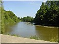
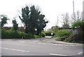
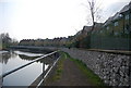
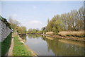
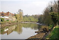
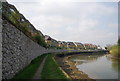
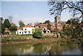
Photos of ME20 7AA


Area Information
ME20 7AA is a small, tightly knit residential postcode area in England, home to 2292 people spread across a compact footprint. With a population density of 506 people per square kilometre, it reflects a modest, community-oriented environment. This area is characterised by its residential cluster, offering a balance between privacy and proximity to essential services. The demographic profile suggests a mature population, with a median age of 47 and a majority of residents aged 30–64. Daily life here is likely shaped by the presence of local shops, rail links, and a low flood risk, making it a practical choice for those seeking a stable, low-maintenance lifestyle. While the area is not densely populated, its small size means residents are close to amenities such as supermarkets, railway stations, and regional airports. The mix of home ownership and rental properties indicates a diverse housing market, though the dominance of houses over flats suggests a preference for traditional, family-friendly living.
- Area Type
- Postcode
- Area Size
- Not available
- Population
- 2292
- Population Density
- 506 people/km²
The property market in ME20 7AA is defined by a 44% home ownership rate, indicating that nearly half of residents rent their homes. The accommodation type is predominantly houses, which are more common than flats or apartments in this small area. This suggests a housing stock that caters to families or individuals seeking traditional, single-family homes. Given the area’s compact size, the limited number of properties means buyers may need to consider nearby postcode areas for a broader selection. The mix of owner-occupied and rental properties implies a dynamic market, though the lack of high-density housing points to a quieter, less commercialised environment. For buyers, this could mean a focus on larger homes with gardens, but competition may be higher for the few available properties.
House Prices in ME20 7AA
No properties found in this postcode.
Energy Efficiency in ME20 7AA
Living in ME20 7AA offers access to a range of nearby amenities that support everyday life. Retail options include M&S Aylesford, Sainsburys Larkfield, and Aldi Aylesford, ensuring convenience for grocery shopping and daily errands. The area’s rail network, with stations such as Aylesford and Barming, provides easy access to broader regional transport links. Rochester Airport is also within practical reach, catering to those with travel needs. While the data does not specify parks or leisure facilities, the presence of multiple retail and transport hubs suggests a lifestyle that balances practicality with accessibility. The compact nature of the area means residents can reach essential services without long commutes, fostering a sense of convenience and self-sufficiency.
Amenities
Schools
| Rank | School | Type | Entry gender | Ages |
|---|
Explore more schools in this area
Go to Schools tabDemographics
The community in ME20 7AA is predominantly composed of adults aged 30–64, with a median age of 47. This suggests a population that is largely settled, with fewer young families or retirees compared to other areas. Home ownership sits at 44%, indicating a significant proportion of residents rent their homes. The accommodation type is primarily houses, which aligns with the area’s character as a residential cluster rather than a high-density housing zone. The predominant ethnic group is White, reflecting a homogenous demographic profile. While no specific data on deprivation is provided, the age distribution and housing stock suggest a stable, middle-aged population with established routines. The absence of detailed diversity metrics means the community’s social fabric remains largely defined by its core demographic.
Household Size
Accommodation Type
Tenure
Ethnic Group
Religion
Household Composition
Age
Household Deprivation
NS-SEC
Explore more demographic insights in this area
Go to Demographics tabPlanning
Planning Constraints
- Flood RiskPremium
- Ramsar Wetland SitesPremium
- Area of Outstanding Natural BeautyPremium
- Protected Nature ReservePremium
- Protected WoodlandPremium