Area Overview for ME20 6HT
Photos of ME20 6HT
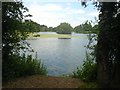
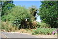
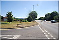
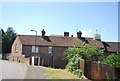
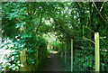
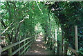
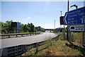
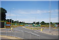

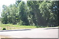
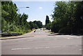
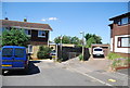
64 photos from this area
Area Information
Key information about the ME20 6HT including its size, population, and administrative classification.
- Area Type
- Postcode
- Area Size
- 5.2 hectares
- Population
- 2132
- Population Density
- 1884 people/km²
House Prices in ME20 6HT
20
Properties
£406,787
Average Sold Price
£69,995
Lowest Price
£1,350,000
Highest Price
Showing 20 properties
| Address | Type | Beds | Baths | Last Sale Price | Last Sale Date | |
|---|---|---|---|---|---|---|
| 251A Lunsford Lane, Larkfield, Aylesford, ME20 6HT | Detached | 2 | 1 | £380,000 | Dec 2024 | |
| Lunsford Hall, 311 Lunsford Lane, Larkfield, Aylesford, ME20 6HT | Detached | 7 | 3 | £1,350,000 | Nov 2022 | |
| 299 Lunsford Lane, Larkfield, Aylesford, ME20 6HT | house | - | - | £375,000 | Jan 2022 | |
| 303 Lunsford Lane, Larkfield, Aylesford, ME20 6HT | Detached | 5 | 2 | £625,000 | Dec 2018 | |
| 237 Lunsford Lane, Larkfield, Aylesford, ME20 6HT | Detached | 5 | 2 | £590,000 | Apr 2017 | |
| 249 Lunsford Lane, Larkfield, Aylesford, ME20 6HT | Semi-detached | 3 | - | £340,000 | Oct 2016 | |
| 245 Lunsford Lane, Larkfield, Aylesford, ME20 6HT | house | - | - | £234,500 | Jun 2012 | |
| 241 Lunsford Lane, Larkfield, Aylesford, ME20 6HT | Semi-detached | - | - | £265,950 | May 2008 | |
| 305 Lunsford Lane, Larkfield, Aylesford, ME20 6HT | Detached | 4 | 2 | £345,000 | Jan 2005 | |
| 313 Lunsford Lane, Larkfield, Aylesford, ME20 6HT | house | - | - | £191,000 | Jan 2004 |
Page 1 of 2
Energy Efficiency in ME20 6HT
Amenities
Schools
| Rank | School | Type | Entry gender | Ages |
|---|
Explore more schools in this area
Go to Schools tabDemographics
Household Size
Two person
most common
Accommodation Type
Houses
most common
Tenure
80
majority
Ethnic Group
White
most common
Religion
N/A
most common
Household Composition
N/A
most common
Age
47
median
Adults (30-64 years)
most common
Household Deprivation
N/A
with no deprivation
NS-SEC
40
in Lower managerial occupations
Explore more demographic insights in this area
Go to Demographics tabPlanning
Planning Constraints
- Flood RiskPremium
- Ramsar Wetland SitesPremium
- Area of Outstanding Natural BeautyPremium
- Protected Nature ReservePremium
- Protected WoodlandPremium