Area Overview for ME2 4QN
Photos of ME2 4QN
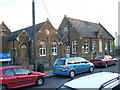
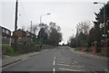
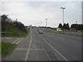
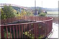
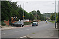

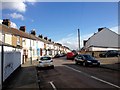
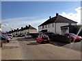
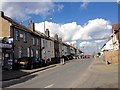
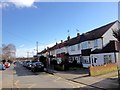
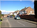
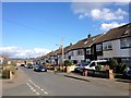
58 photos from this area
Area Information
Key information about the ME2 4QN including its size, population, and administrative classification.
- Area Type
- Postcode
- Area Size
- 8918 m²
- Population
- 2185
- Population Density
- 2513 people/km²
House Prices in ME2 4QN
18
Properties
£213,295
Average Sold Price
£78,000
Lowest Price
£305,000
Highest Price
Showing 18 properties
| Address | Type | Beds | Baths | Last Sale Price | Last Sale Date | |
|---|---|---|---|---|---|---|
| 30 Hilltop Road, Wainscott, Rochester, ME2 4QN | Retail | 3 | 1 | £305,000 | Aug 2022 | |
| 4 Hilltop Road, Wainscott, Rochester, ME2 4QN | Terraced | 4 | - | £300,000 | Oct 2021 | |
| 32 Hilltop Road, Wainscott, Rochester, ME2 4QN | Terraced | 3 | 1 | £295,000 | Feb 2021 | |
| 18 Hilltop Road, Wainscott, Rochester, ME2 4QN | Terraced | 2 | 1 | £242,500 | May 2020 | |
| 8 Hilltop Road, Wainscott, Rochester, ME2 4QN | house | - | - | £180,000 | Mar 2019 | |
| 22 Hilltop Road, Wainscott, Rochester, ME2 4QN | Terraced | 3 | 1 | £215,000 | Nov 2015 | |
| 6 Hilltop Road, Wainscott, Rochester, ME2 4QN | Terraced | - | - | £189,950 | Oct 2007 | |
| 34 Hilltop Road, Wainscott, Rochester, ME2 4QN | Terraced | - | - | £177,500 | Jun 2007 | |
| 28 Hilltop Road, Wainscott, Rochester, ME2 4QN | Terraced | - | - | £150,000 | Sep 2005 | |
| 16 Hilltop Road, Wainscott, Rochester, ME2 4QN | Terraced | - | - | £78,000 | May 1999 |
Page 1 of 2
Energy Efficiency in ME2 4QN
Amenities
Schools
| Rank | School | Type | Entry gender | Ages |
|---|
Explore more schools in this area
Go to Schools tabDemographics
Household Size
Family (3-5 people)
most common
Accommodation Type
Houses
most common
Tenure
87
majority
Ethnic Group
White
most common
Religion
N/A
most common
Household Composition
N/A
most common
Age
47
median
Adults (30-64 years)
most common
Household Deprivation
N/A
with no deprivation
NS-SEC
38
in Lower managerial occupations
Explore more demographic insights in this area
Go to Demographics tabPlanning
Planning Constraints
- Flood RiskPremium
- Ramsar Wetland SitesPremium
- Area of Outstanding Natural BeautyPremium
- Protected Nature ReservePremium
- Protected WoodlandPremium