Area Overview for ME2 4AJ
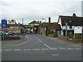
Photos of ME2 4AJ


Area Information
ME2 4AJ is a small residential cluster in England, home to 1,732 residents. The area’s compact size fosters a close-knit community, with most homes being owner-occupied and predominantly houses rather than flats. The median age of 47 suggests a mature population, with adults aged 30–64 forming the largest demographic group. Daily life here is shaped by proximity to practical amenities, including five retail outlets like Iceland Strood and M&S Strood, and multiple rail stations such as Strood and Rochester. The area’s digital connectivity is strong, with broadband scoring 92/100 and mobile coverage 85/100, supporting both remote work and everyday internet needs. While the population is small, the presence of Rochester Airport nearby adds convenience for travel. The area’s low flood risk and absence of environmental constraints like AONB or protected woodlands suggest a stable, unobstructed living environment. However, crime risk is high, with a safety score of 2/100, warranting caution. For those seeking a quiet, residential setting with accessible transport and retail, ME2 4AJ offers a distinct blend of practicality and proximity.
- Area Type
- Postcode
- Area Size
- Not available
- Population
- 1732
- Population Density
- 2362 people/km²
ME2 4AJ is primarily an owner-occupied area, with 65% of homes owned by residents rather than rented. The housing stock consists predominantly of houses, not flats, which is typical for smaller, residential postcode areas. This suggests a market skewed towards family homes and long-term buyers, with limited rental availability. The small population and compact size mean the property market is likely niche, with limited scope for new developments. Buyers should consider the proximity to rail networks, including Strood and Rochester stations, which enhance connectivity. The broadband score of 92/100 and mobile coverage of 85/100 support modern living needs, though the high crime risk may affect desirability. For those seeking a quiet, residential area with established housing, ME2 4AJ offers a specific, if limited, market.
House Prices in ME2 4AJ
No properties found in this postcode.
Energy Efficiency in ME2 4AJ
Living in ME2 4AJ offers access to a range of practical amenities within reach. Retail options include Iceland Strood, M&S Strood, and Aldi Frindsbury, providing everyday shopping convenience. The area’s rail network, with stations like Strood and Rochester, facilitates easy travel to nearby towns and cities. Rochester Airport is a notable nearby feature, offering direct flight connections. While the data does not list parks or leisure facilities, the absence of environmental constraints like AONB or protected woodlands suggests open spaces may be available. The compact nature of the area means amenities are concentrated, reducing the need for long commutes. This blend of retail, transport, and travel options supports a lifestyle focused on accessibility and practicality, though residents may need to venture further for more diverse leisure opportunities.
Amenities
Schools
The nearest school to ME2 4AJ is FORWARD2 Employment Limited, a special school. No other schools are listed in the data, meaning families may need to look beyond the immediate area for primary or secondary education. The absence of mainstream schools suggests a reliance on nearby towns for broader educational options. This could be a consideration for families prioritising school proximity. The single listed school’s focus on special needs indicates a tailored approach to education, but the lack of data on its Ofsted rating or performance means further research would be necessary. Residents may need to evaluate the adequacy of local and regional school provision when assessing the area’s suitability for children.
| Rank | School | Type | Entry gender | Ages |
|---|
Explore more schools in this area
Go to Schools tabDemographics
The population of ME2 4AJ is 1,732, with a median age of 47. The majority of residents fall within the 30–64 age range, indicating a community of working-age adults and older homeowners. Home ownership is high, at 65%, suggesting stability and long-term residency. The area is characterised by houses rather than flats, reflecting a preference for single-family dwellings. The predominant ethnic group is White, though no specific data on diversity or deprivation is provided. This demographic profile implies a mature, settled population with established routines. The high home ownership rate may correlate with lower rental demand, potentially influencing property values and community dynamics. With no data on household composition or income distribution, the focus remains on the age and ownership structure, which shape local services and amenities.
Household Size
Accommodation Type
Tenure
Ethnic Group
Religion
Household Composition
Age
Household Deprivation
NS-SEC
Explore more demographic insights in this area
Go to Demographics tabPlanning
Planning Constraints
- Flood RiskPremium
- Ramsar Wetland SitesPremium
- Area of Outstanding Natural BeautyPremium
- Protected Nature ReservePremium
- Protected WoodlandPremium