Area Overview for ME2 3UN
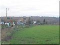
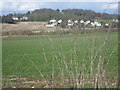
Photos of ME2 3UN


Area Information
Living in ME2 3UN means being part of a compact, residential postcode area in England with a population of 1,296 people. The density of 449 people per square kilometre suggests a tightly knit community, where daily life is shaped by proximity to local amenities and transport links. This area is not a sprawling suburb but a focused cluster of homes, likely centred around key infrastructure like rail stations and retail hubs. The demographic profile—predominantly adults aged 30–64—hints at a mature, stable population, with 92% owning their homes. This high ownership rate suggests long-term residency and a sense of permanence. While the area lacks major landmarks or natural features, its practical location near multiple rail stations, ferry terminals, and retail outlets makes it convenient for commuters and families. The presence of independent schools like Gad’s Hill School adds to its appeal for households prioritising education. For those seeking a quiet, well-connected residential spot with access to essential services, ME2 3UN offers a blend of practicality and community cohesion.
- Area Type
- Postcode
- Area Size
- Not available
- Population
- 1296
- Population Density
- 449 people/km²
ME2 3UN is a predominantly owner-occupied area, with 92% of homes owned by residents rather than rented. This high ownership rate suggests a community of long-term residents, which can stabilise property values and reduce rental availability. The accommodation type is primarily houses, which is unusual for areas with high population density but aligns with the postcode’s small, residential character. This housing stock may appeal to families or individuals seeking larger living spaces, though the limited number of properties means the market is likely small and niche. Buyers should consider nearby areas for more options, as the immediate surroundings may not offer extensive property diversity. The focus on owner-occupation also implies fewer short-term rental properties, which could be a consideration for investors. For those prioritising home ownership in a quiet, established area, ME2 3UN offers a compact, stable market.
House Prices in ME2 3UN
No properties found in this postcode.
Energy Efficiency in ME2 3UN
Residents of ME2 3UN have access to a range of nearby amenities within practical reach. The retail sector includes five shops, with notable names like Morrisons Daily, Asda Strood, and Tesco Strood, offering everyday essentials and grocery needs. The area’s rail network is extensive, with five stations providing connections to key destinations. For those preferring water transport, three ferry terminals—Town Pier, West Street Pier, and Tilbury—offer links to nearby locations. Rochester Airport adds to the transport options, accommodating regional travel. While the area lacks large-scale leisure facilities, the proximity to rail and ferry services ensures residents can access broader opportunities beyond the immediate postcode. The mix of retail, transport, and travel options supports a practical, convenience-driven lifestyle, though the area’s character is defined more by accessibility than by vibrant urban amenities.
Amenities
Schools
The nearest school to ME2 3UN is Gad’s Hill School, an independent institution. While no Ofsted rating is provided, the presence of an independent school suggests a focus on private education, which may appeal to families seeking alternative schooling options. The lack of state schools in the immediate area means residents must look further afield for public education, which could be a factor for households prioritising affordability or accessibility. Independent schools often cater to specific educational philosophies or specialisms, so parents should investigate the school’s curriculum and facilities. For those valuing private education, Gad’s Hill School offers a dedicated option, though its exact academic performance remains unspecified. The limited school choice in the area underscores the need for careful research into local educational provision.
| Rank | School | Type | Entry gender | Ages |
|---|
Explore more schools in this area
Go to Schools tabDemographics
The population of ME2 3UN is predominantly adults aged 30–64, with a median age of 47. This suggests a community of established professionals, families, and retirees, rather than a transient student or younger population. Home ownership is exceptionally high at 92%, indicating a strong preference for long-term residency over renting. The accommodation type is primarily houses, which aligns with the higher ownership rates and suggests a more traditional, family-oriented housing stock. The predominant ethnic group is White, reflecting a homogenous demographic profile. While no specific data on deprivation is provided, the high home ownership and stable age range imply a relatively affluent, low-volatility community. The absence of significant diversity data means the area’s social fabric is likely shaped by shared cultural and economic experiences. For buyers, this demographic stability may translate into predictable property values and a consistent local environment.
Household Size
Accommodation Type
Tenure
Ethnic Group
Religion
Household Composition
Age
Household Deprivation
NS-SEC
Explore more demographic insights in this area
Go to Demographics tabPlanning
Planning Constraints
- Flood RiskPremium
- Ramsar Wetland SitesPremium
- Area of Outstanding Natural BeautyPremium
- Protected Nature ReservePremium
- Protected WoodlandPremium