Area Overview for ME2 3TD
Photos of ME2 3TD


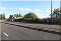
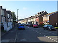

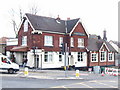
48 photos from this area
Area Information
Key information about the ME2 3TD including its size, population, and administrative classification.
- Area Type
- Postcode
- Area Size
- 9822 m²
- Population
- 1494
- Population Density
- 4145 people/km²
House Prices in ME2 3TD
32
Properties
£251,400
Average Sold Price
£85,000
Lowest Price
£418,000
Highest Price
Showing 32 properties
| Address | Type | Beds | Baths | Last Sale Price | Last Sale Date | |
|---|---|---|---|---|---|---|
| 183 Allington Drive, Strood, Rochester, ME2 3TD | Semi-detached | 3 | 1 | £418,000 | Mar 2025 | |
| 161 Allington Drive, Strood, Rochester, ME2 3TD | Semi-detached | 3 | 1 | £415,000 | May 2023 | |
| 144 Allington Drive, Strood, Rochester, ME2 3TD | house | - | - | £156,000 | Aug 2022 | |
| 124 Allington Drive, Strood, Rochester, ME2 3TD | house | 3 | - | £330,000 | Jun 2021 | |
| 185 Allington Drive, Strood, Rochester, ME2 3TD | house | - | - | £350,000 | Jan 2021 | |
| 189 Allington Drive, Strood, Rochester, ME2 3TD | Terraced | 3 | 1 | £335,000 | Aug 2020 | |
| 171 Allington Drive, Strood, Rochester, ME2 3TD | Semi-detached | 4 | 2 | £342,000 | Jan 2020 | |
| 142 Allington Drive, Strood, Rochester, ME2 3TD | Semi-detached | 3 | 1 | £303,000 | Apr 2018 | |
| 140 Allington Drive, Strood, Rochester, ME2 3TD | Semi-detached | 5 | 2 | £360,000 | Jun 2016 | |
| 163 Allington Drive, Strood, Rochester, ME2 3TD | Terraced | - | - | £182,500 | Dec 2004 |
Page 1 of 4
Energy Efficiency in ME2 3TD
Amenities
Schools
| Rank | School | Type | Entry gender | Ages |
|---|
Explore more schools in this area
Go to Schools tabDemographics
Household Size
Family (3-5 people)
most common
Accommodation Type
Houses
most common
Tenure
91
majority
Ethnic Group
White
most common
Religion
N/A
most common
Household Composition
N/A
most common
Age
47
median
Adults (30-64 years)
most common
Household Deprivation
N/A
with no deprivation
NS-SEC
33
in Lower managerial occupations
Explore more demographic insights in this area
Go to Demographics tabPlanning
Planning Constraints
- Flood RiskPremium
- Ramsar Wetland SitesPremium
- Area of Outstanding Natural BeautyPremium
- Protected Nature ReservePremium
- Protected WoodlandPremium