Area Overview for ME2 3RS
Photos of ME2 3RS


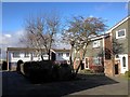
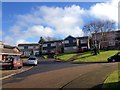

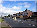
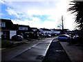


31 photos from this area
Area Information
Key information about the ME2 3RS including its size, population, and administrative classification.
- Area Type
- Postcode
- Area Size
- 2.6 hectares
- Population
- 1390
- Population Density
- 2004 people/km²
House Prices in ME2 3RS
31
Properties
£249,553
Average Sold Price
£50,000
Lowest Price
£555,000
Highest Price
Showing 31 properties
| Address | Type | Beds | Baths | Last Sale Price | Last Sale Date | |
|---|---|---|---|---|---|---|
| 23 Farm Hill Avenue, Strood, Rochester, ME2 3RS | Semi-detached | 4 | 3 | £555,000 | Dec 2022 | |
| 20 Farm Hill Avenue, Strood, Rochester, ME2 3RS | Semi-detached | 4 | 1 | £382,000 | Jan 2021 | |
| 15 Farm Hill Avenue, Strood, Rochester, ME2 3RS | Semi-detached | 3 | 2 | £322,500 | Sep 2019 | |
| 24 Farm Hill Avenue, Strood, Rochester, ME2 3RS | Semi-detached | 3 | 1 | £320,000 | May 2018 | |
| 25 Farm Hill Avenue, Strood, Rochester, ME2 3RS | Semi-detached | 4 | - | £405,000 | Jul 2017 | |
| 10 Farm Hill Avenue, Strood, Rochester, ME2 3RS | Bungalow | 2 | 1 | £268,000 | Jun 2017 | |
| 29 Farm Hill Avenue, Strood, Rochester, ME2 3RS | Semi-detached | 4 | 2 | £462,500 | Jun 2017 | |
| 4 Farm Hill Avenue, Strood, Rochester, ME2 3RS | Bungalow | - | - | £250,000 | Dec 2016 | |
| 26 Farm Hill Avenue, Strood, Rochester, ME2 3RS | house | - | - | £212,000 | May 2013 | |
| 13 Farm Hill Avenue, Strood, Rochester, ME2 3RS | Semi-detached | 3 | - | £201,000 | Mar 2013 |
Page 1 of 4
Energy Efficiency in ME2 3RS
Amenities
Schools
| Rank | School | Type | Entry gender | Ages |
|---|
Explore more schools in this area
Go to Schools tabDemographics
Household Size
Two person
most common
Accommodation Type
Houses
most common
Tenure
93
majority
Ethnic Group
White
most common
Religion
N/A
most common
Household Composition
N/A
most common
Age
47
median
Adults (30-64 years)
most common
Household Deprivation
N/A
with no deprivation
NS-SEC
35
in Lower managerial occupations
Explore more demographic insights in this area
Go to Demographics tabPlanning
Planning Constraints
- Flood RiskPremium
- Ramsar Wetland SitesPremium
- Area of Outstanding Natural BeautyPremium
- Protected Nature ReservePremium
- Protected WoodlandPremium