Area Overview for ME2 3QZ
Photos of ME2 3QZ


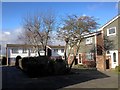
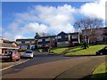

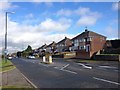
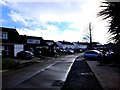
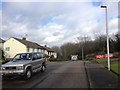

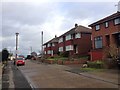

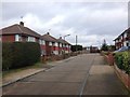
31 photos from this area
Area Information
Key information about the ME2 3QZ including its size, population, and administrative classification.
- Area Type
- Postcode
- Area Size
- 5.3 hectares
- Population
- 1390
- Population Density
- 2004 people/km²
House Prices in ME2 3QZ
25
Properties
£321,167
Average Sold Price
£80,000
Lowest Price
£480,000
Highest Price
Showing 25 properties
| Address | Type | Beds | Baths | Last Sale Price | Last Sale Date | |
|---|---|---|---|---|---|---|
| 92 Brompton Farm Road, Strood, Rochester, ME2 3QZ | Bungalow | 3 | 1 | £480,000 | Oct 2025 | |
| 110 Brompton Farm Road, Strood, Rochester, ME2 3QZ | Semi-detached | 3 | 1 | £370,000 | Jun 2023 | |
| 102 Brompton Farm Road, Strood, Rochester, ME2 3QZ | Semi-detached | 3 | 1 | £388,500 | Mar 2023 | |
| 112 Brompton Farm Road, Strood, Rochester, ME2 3QZ | Semi-detached | 3 | 1 | £360,500 | Dec 2019 | |
| 130 Brompton Farm Road, Strood, Rochester, ME2 3QZ | Semi-detached | 3 | - | £345,000 | Aug 2019 | |
| 116 Brompton Farm Road, Strood, Rochester, ME2 3QZ | Bungalow | 4 | 1 | £405,000 | Oct 2018 | |
| 94 Brompton Farm Road, Strood, Rochester, ME2 3QZ | Bungalow | 2 | 1 | £360,000 | Mar 2016 | |
| 100 Brompton Farm Road, Strood, Rochester, ME2 3QZ | Semi-detached | 3 | 1 | £295,000 | Nov 2015 | |
| 114 Brompton Farm Road, Strood, Rochester, ME2 3QZ | Bungalow | 3 | - | £300,000 | Jun 2013 | |
| 126 Brompton Farm Road, Strood, Rochester, ME2 3QZ | house | - | - | £227,000 | Jul 2009 |
Page 1 of 3
Energy Efficiency in ME2 3QZ
Amenities
Schools
| Rank | School | Type | Entry gender | Ages |
|---|
Explore more schools in this area
Go to Schools tabDemographics
Household Size
Two person
most common
Accommodation Type
Houses
most common
Tenure
93
majority
Ethnic Group
White
most common
Religion
N/A
most common
Household Composition
N/A
most common
Age
47
median
Adults (30-64 years)
most common
Household Deprivation
N/A
with no deprivation
NS-SEC
35
in Lower managerial occupations
Explore more demographic insights in this area
Go to Demographics tabPlanning
Planning Constraints
- Flood RiskPremium
- Ramsar Wetland SitesPremium
- Area of Outstanding Natural BeautyPremium
- Protected Nature ReservePremium
- Protected WoodlandPremium