Area Overview for ME2 3QT
Photos of ME2 3QT


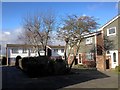
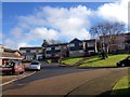

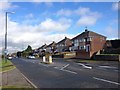
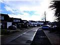
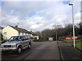

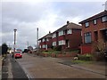

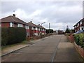
31 photos from this area
Area Information
Key information about the ME2 3QT including its size, population, and administrative classification.
- Area Type
- Postcode
- Area Size
- 7.3 hectares
- Population
- 1390
- Population Density
- 2004 people/km²
House Prices in ME2 3QT
19
Properties
£410,727
Average Sold Price
£165,000
Lowest Price
£800,000
Highest Price
Showing 19 properties
| Address | Type | Beds | Baths | Last Sale Price | Last Sale Date | |
|---|---|---|---|---|---|---|
| 140 Gravesend Road, Strood, Rochester, ME2 3QT | Detached | 3 | 2 | £665,000 | Jun 2023 | |
| 152 Gravesend Road, Strood, Rochester, ME2 3QT | house | 4 | - | £800,000 | Sep 2021 | |
| 148 Gravesend Road, Strood, Rochester, ME2 3QT | Detached | - | - | £565,000 | Aug 2019 | |
| 134 Gravesend Road, Strood, Rochester, ME2 3QT | Detached | 4 | 1 | £365,000 | Apr 2014 | |
| 160 Gravesend Road, Strood, Rochester, ME2 3QT | Bungalow | - | - | £550,000 | Jun 2013 | |
| 146 Gravesend Road, Strood, Rochester, ME2 3QT | Detached | - | - | £320,000 | Mar 2005 | |
| 142 Gravesend Road, Strood, Rochester, ME2 3QT | Detached | - | - | £299,995 | Sep 2003 | |
| 162 Gravesend Road, Strood, Rochester, ME2 3QT | Detached | - | - | £400,000 | Aug 2002 | |
| 138 Gravesend Road, Strood, Rochester, ME2 3QT | Detached | - | - | £220,000 | Aug 2001 | |
| 150 Gravesend Road, Strood, Rochester, ME2 3QT | Detached | 4 | 2 | £168,000 | Jul 1998 |
Page 1 of 2
Energy Efficiency in ME2 3QT
Amenities
Schools
| Rank | School | Type | Entry gender | Ages |
|---|
Explore more schools in this area
Go to Schools tabDemographics
Household Size
Two person
most common
Accommodation Type
Houses
most common
Tenure
93
majority
Ethnic Group
White
most common
Religion
N/A
most common
Household Composition
N/A
most common
Age
47
median
Adults (30-64 years)
most common
Household Deprivation
N/A
with no deprivation
NS-SEC
35
in Lower managerial occupations
Explore more demographic insights in this area
Go to Demographics tabPlanning
Planning Constraints
- Flood RiskPremium
- Ramsar Wetland SitesPremium
- Area of Outstanding Natural BeautyPremium
- Protected Nature ReservePremium
- Protected WoodlandPremium