Area Overview for ME2 3NB
Photos of ME2 3NB


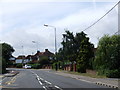
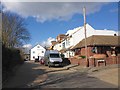
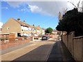
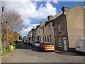
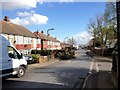
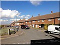
60 photos from this area
Area Information
Key information about the ME2 3NB including its size, population, and administrative classification.
- Area Type
- Postcode
- Area Size
- 1.7 hectares
- Population
- 1405
- Population Density
- 4663 people/km²
House Prices in ME2 3NB
26
Properties
£308,467
Average Sold Price
£99,400
Lowest Price
£625,000
Highest Price
Showing 26 properties
| Address | Type | Beds | Baths | Last Sale Price | Last Sale Date | |
|---|---|---|---|---|---|---|
| 40 King Arthurs Drive, Strood, Rochester, ME2 3NB | Bungalow | 4 | - | £430,000 | Dec 2022 | |
| 45 King Arthurs Drive, Strood, Rochester, ME2 3NB | Semi-detached | 3 | - | £340,000 | Jun 2022 | |
| 60 King Arthurs Drive, Strood, Rochester, ME2 3NB | Detached | 3 | 2 | £400,000 | Sep 2021 | |
| 66 King Arthurs Drive, Strood, Rochester, ME2 3NB | Semi-detached | 3 | - | £518,000 | Aug 2021 | |
| 55 King Arthurs Drive, Strood, Rochester, ME2 3NB | Bungalow | 4 | 1 | £465,000 | Aug 2020 | |
| 63 King Arthurs Drive, Strood, Rochester, ME2 3NB | Semi-detached | 3 | 1 | £350,000 | Mar 2020 | |
| 35 King Arthurs Drive, Strood, Rochester, ME2 3NB | Detached | 4 | 1 | £625,000 | Dec 2019 | |
| 43 King Arthurs Drive, Strood, Rochester, ME2 3NB | house | - | - | £375,000 | Jul 2019 | |
| 57 King Arthurs Drive, Strood, Rochester, ME2 3NB | Bungalow | - | - | £280,000 | Aug 2015 | |
| 41 King Arthurs Drive, Strood, Rochester, ME2 3NB | house | - | - | £245,000 | Jan 2013 |
Page 1 of 3
Energy Efficiency in ME2 3NB
Amenities
Schools
| Rank | School | Type | Entry gender | Ages |
|---|
Explore more schools in this area
Go to Schools tabDemographics
Household Size
Family (3-5 people)
most common
Accommodation Type
Houses
most common
Tenure
79
majority
Ethnic Group
White
most common
Religion
N/A
most common
Household Composition
N/A
most common
Age
47
median
Adults (30-64 years)
most common
Household Deprivation
N/A
with no deprivation
NS-SEC
38
in Lower managerial occupations
Explore more demographic insights in this area
Go to Demographics tabPlanning
Planning Constraints
- Flood RiskPremium
- Ramsar Wetland SitesPremium
- Area of Outstanding Natural BeautyPremium
- Protected Nature ReservePremium
- Protected WoodlandPremium