Area Overview for ME2 3DD
Photos of ME2 3DD


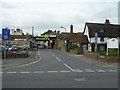

100 photos from this area
Area Information
Key information about the ME2 3DD including its size, population, and administrative classification.
- Area Type
- Postcode
- Area Size
- 7177 m²
- Population
- 1524
- Population Density
- 7366 people/km²
House Prices in ME2 3DD
37
Properties
£273,638
Average Sold Price
£76,000
Lowest Price
£607,500
Highest Price
Showing 37 properties
| Address | Type | Beds | Baths | Last Sale Price | Last Sale Date | |
|---|---|---|---|---|---|---|
| 22 Goddington Road, Strood, Rochester, ME2 3DD | house | 5 | 1 | £425,000 | Jun 2025 | |
| 29 Goddington Road, Strood, Rochester, ME2 3DD | Detached | 4 | 2 | £607,500 | Mar 2025 | |
| 18 Goddington Road, Strood, Rochester, ME2 3DD | Semi-detached | 4 | 2 | £420,000 | Jan 2025 | |
| 15 Goddington Road, Strood, Rochester, ME2 3DD | Terraced | 3 | 1 | £295,000 | Oct 2023 | |
| 8 Goddington Road, Strood, Rochester, ME2 3DD | Semi-detached | 4 | 2 | £390,000 | Oct 2020 | |
| 12 Goddington Road, Strood, Rochester, ME2 3DD | house | - | - | £435,000 | Oct 2019 | |
| 2 Goddington Road, Strood, Rochester, ME2 3DD | house | - | - | £599,995 | Mar 2017 | |
| 27 Goddington Road, Strood, Rochester, ME2 3DD | Semi-detached | - | - | £380,000 | Dec 2014 | |
| 7 Goddington Road, Strood, Rochester, ME2 3DD | Terraced | - | - | £128,500 | Oct 2012 | |
| 9 Goddington Road, Strood, Rochester, ME2 3DD | Terraced | 3 | 1 | £140,000 | Dec 2009 |
Page 1 of 4
Energy Efficiency in ME2 3DD
Amenities
Schools
| Rank | School | Type | Entry gender | Ages |
|---|
Explore more schools in this area
Go to Schools tabDemographics
Household Size
One person
most common
Accommodation Type
Houses
most common
Tenure
46
majority
Ethnic Group
White
most common
Religion
N/A
most common
Household Composition
N/A
most common
Age
47
median
Adults (30-64 years)
most common
Household Deprivation
N/A
with no deprivation
NS-SEC
25
in Lower managerial occupations
Explore more demographic insights in this area
Go to Demographics tabPlanning
Planning Constraints
- Flood RiskPremium
- Ramsar Wetland SitesPremium
- Area of Outstanding Natural BeautyPremium
- Protected Nature ReservePremium
- Protected WoodlandPremium