Area Overview for ME2 3AF
Photos of ME2 3AF


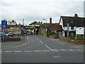

100 photos from this area
Area Information
Key information about the ME2 3AF including its size, population, and administrative classification.
- Area Type
- Postcode
- Area Size
- 4559 m²
- Population
- 1592
- Population Density
- 7419 people/km²
House Prices in ME2 3AF
27
Properties
£147,100
Average Sold Price
£36,000
Lowest Price
£260,000
Highest Price
Showing 27 properties
| Address | Type | Beds | Baths | Last Sale Price | Last Sale Date | |
|---|---|---|---|---|---|---|
| 13 Hone Street, Strood, Rochester, ME2 3AF | house | 2 | 1 | £175,000 | May 2025 | |
| 19 Hone Street, Strood, Rochester, ME2 3AF | house | - | - | £225,000 | Aug 2023 | |
| 5 Hone Street, Strood, Rochester, ME2 3AF | Terraced | 2 | 1 | £210,000 | May 2023 | |
| 7 Hone Street, Strood, Rochester, ME2 3AF | Terraced | 2 | 1 | £212,000 | Dec 2022 | |
| 24 Hone Street, Strood, Rochester, ME2 3AF | Terraced | 3 | 1 | £260,000 | Mar 2022 | |
| 17 Hone Street, Strood, Rochester, ME2 3AF | house | - | - | £210,000 | Feb 2022 | |
| 18 Hone Street, Strood, Rochester, ME2 3AF | house | - | - | £219,000 | Mar 2021 | |
| 22 Hone Street, Strood, Rochester, ME2 3AF | Terraced | 3 | 1 | £208,000 | Mar 2021 | |
| 8 Hone Street, Strood, Rochester, ME2 3AF | house | 2 | 1 | £187,500 | Dec 2020 | |
| 9 Hone Street, Strood, Rochester, ME2 3AF | Terraced | 2 | 1 | £187,000 | Jun 2020 |
Page 1 of 3
Energy Efficiency in ME2 3AF
Amenities
Schools
| Rank | School | Type | Entry gender | Ages |
|---|
Explore more schools in this area
Go to Schools tabDemographics
Household Size
Family (3-5 people)
most common
Accommodation Type
Houses
most common
Tenure
57
majority
Ethnic Group
White
most common
Religion
N/A
most common
Household Composition
N/A
most common
Age
47
median
Adults (30-64 years)
most common
Household Deprivation
N/A
with no deprivation
NS-SEC
25
in Lower managerial occupations
Explore more demographic insights in this area
Go to Demographics tabPlanning
Planning Constraints
- Flood RiskPremium
- Ramsar Wetland SitesPremium
- Area of Outstanding Natural BeautyPremium
- Protected Nature ReservePremium
- Protected WoodlandPremium