Area Overview for ME2 2SG
Photos of ME2 2SG


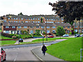
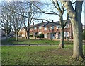
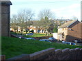


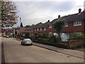
39 photos from this area
Area Information
Key information about the ME2 2SG including its size, population, and administrative classification.
- Area Type
- Postcode
- Area Size
- 1.0 hectares
- Population
- 1664
- Population Density
- 3646 people/km²
House Prices in ME2 2SG
26
Properties
£223,182
Average Sold Price
£27,000
Lowest Price
£340,000
Highest Price
Showing 26 properties
| Address | Type | Beds | Baths | Last Sale Price | Last Sale Date | |
|---|---|---|---|---|---|---|
| 24 Seagull Road, Strood, Rochester, ME2 2SG | Terraced | 3 | 1 | £340,000 | Dec 2025 | |
| 38 Seagull Road, Strood, Rochester, ME2 2SG | house | - | - | £265,000 | Mar 2025 | |
| 48 Seagull Road, Strood, Rochester, ME2 2SG | Semi-detached | 3 | 1 | £310,000 | Jun 2024 | |
| 28 Seagull Road, Strood, Rochester, ME2 2SG | Terraced | 4 | 1 | £340,000 | Feb 2024 | |
| 26 Seagull Road, Strood, Rochester, ME2 2SG | house | 3 | 1 | £290,000 | Nov 2022 | |
| 12 Seagull Road, Strood, Rochester, ME2 2SG | Terraced | 3 | 1 | £270,000 | Jun 2021 | |
| 42 Seagull Road, Strood, Rochester, ME2 2SG | Semi-detached | 3 | 1 | £250,000 | Dec 2016 | |
| 18 Seagull Road, Strood, Rochester, ME2 2SG | Terraced | - | - | £145,000 | Mar 2009 | |
| 30 Seagull Road, Strood, Rochester, ME2 2SG | house | - | - | £163,000 | May 2005 | |
| 16 Seagull Road, Strood, Rochester, ME2 2SG | house | - | - | £27,000 | Feb 2002 |
Page 1 of 3
Energy Efficiency in ME2 2SG
Amenities
Schools
| Rank | School | Type | Entry gender | Ages |
|---|
Explore more schools in this area
Go to Schools tabDemographics
Household Size
Family (3-5 people)
most common
Accommodation Type
Houses
most common
Tenure
64
majority
Ethnic Group
White
most common
Religion
N/A
most common
Household Composition
N/A
most common
Age
47
median
Adults (30-64 years)
most common
Household Deprivation
N/A
with no deprivation
NS-SEC
21
in Lower managerial occupations
Explore more demographic insights in this area
Go to Demographics tabPlanning
Planning Constraints
- Flood RiskPremium
- Ramsar Wetland SitesPremium
- Area of Outstanding Natural BeautyPremium
- Protected Nature ReservePremium
- Protected WoodlandPremium